
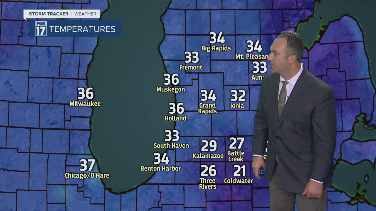


WEST MICHIGAN — WEST MICHIGAN — The forecast from FOX 17 Meteorologist Anthony Domol: After a fair amount of clouds and chilly conditions once again on Tuesday, we return to good sunshine for Wednesday and Thursday as temperatures bounce back well into the upper 40s. The next system of significance looks to arrive Friday afternoon into Saturday with a pattern of rainfall. We may see a changeover to snow showers later Saturday into early Sunday of this upcoming weekend.
TONIGHT: Mostly cloudy. Lows in the upper 20s. Light northwest winds become variable.
TOMORROW/TUESDAY: Mostly cloudy. Highs in the upper 30s. Breezy west to southwest winds at 10-20 mph.
TUESDAY NIGHT: Mostly cloudy. Lows in the lower 30s. Southwest to west winds at 10-15 mph.
WEDNESDAY: Decreasing cloud cover early, becoming mostly sunny. Warmer with highs in the middle to upper 40s. West winds at 10-15 mph.
THURSDAY: Partly cloudy to mostly sunny. Highs in the upper 40s.
