
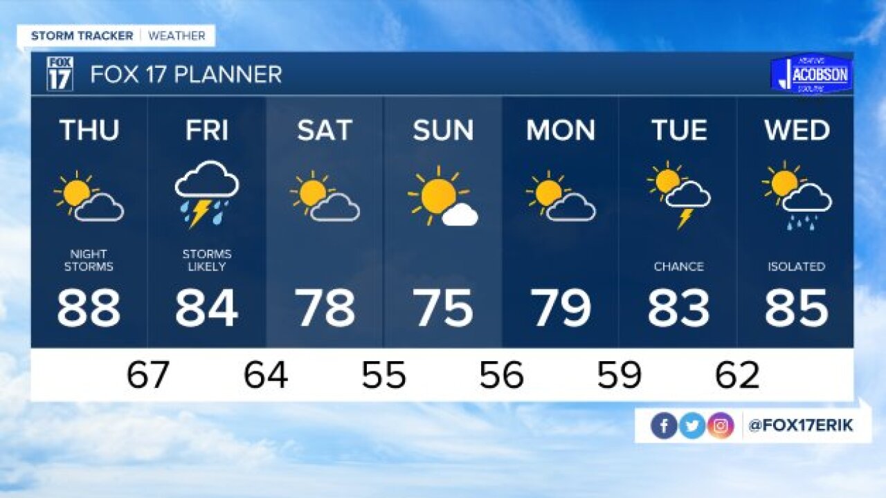


GRAND RAPIDS — GRAND RAPIDS — The forecast from FOX 17 Meteorologist Erik Kostrzewa: The weather looks tranquil tonight and tomorrow, but it will be uncomfortably warm and humid. Storm chances will gradually increase from Thursday evening into Friday morning as a disturbance moves in from the west. A few of these storms could be strong to severe area-wide with the possibility of high winds. A cold front sliding through late Friday night and early Saturday morning could bring thunderstorms with locally heavy rainfall to the area. Strong to severe thunderstorms are possible along and south of I-96 with the cold front.
TONIGHT: Partly cloudy and very muggy. Lows in the mid 70s. Southwest winds at 10 to 15 mph.
TOMORROW: Partly cloudy, hot, and humid. Highs in the upper 80s to around 90°, but heat indicies could reach the mid to upper 90s. West winds at 5 to 15 mph.
TOMORROW NIGHT: A chance of showers and thunderstorms, mainly late. Some of these may be strong to severe. Lows in the mid/upper 60s. West winds at 5 to 10 mph becoming northeast late.
FRIDAY: Mostly cloudy with showers and storms likely. Highs in the low to mid 80s. Variable winds at 5 to 10 mph.
SATURDAY: Lingering early morning showers otherwise drying out and becoming partly cloudy. Cooler and more comfortable with highs in the upper 70s near 80°.
