


GRAND RAPIDS — West Michigan woke up to a bitter cold morning on Saturday as cloud cover started to break up. We will end up with calm winds for the day and temperatures a bit below average pushing into t he upper 20s. Plenty of sunshine on tap with high pressure near by to enjoy!

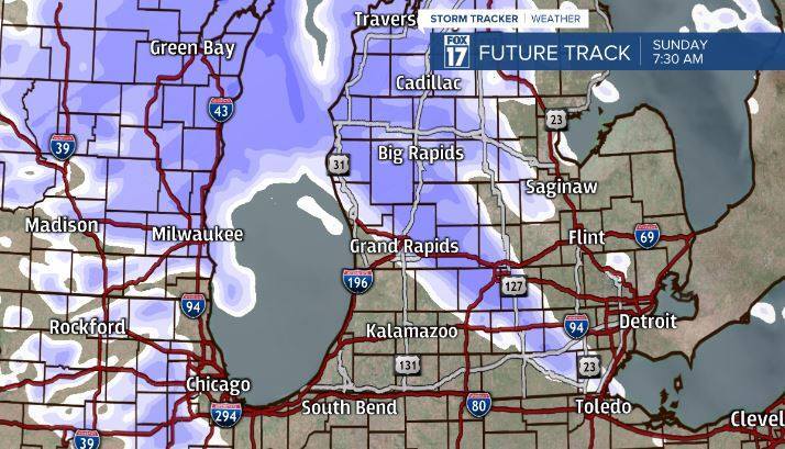
Overnight we will gain cloud cover and start to work towards snow building in. Lighter snow will be around for the first half of Sunday mostly along and north of I-96. If you live south of I-96 you can still see snow just lighter amounts. By the early to mid afternoon the snow will begin to shut off after dropping a general 1-2 inches mainly along and north of I-96.

Monday we will start off dry, but in the second half of the day we will develop snow with our next system moving in. Models are still not agreeing with where this system will set up whether it be more north or more south. We do know that there will be some heavier snow in this system. It will continue Monday overnight throughout Tuesday. Plan ahead for a challenging Tuesday morning and possibly evening commute now. A general 3-6 inches of snowfall is possible with some location gaining upwards of 7-8 inches of snowfall. Models either have the heaviest snow falling between I-96 and I-94 or all around I-94. Check back for updates as we get closer.


Temperatures this week stay roughly around average in the upper 20s and lower 30s. A little bit of everything for everyone whether you like winter sunshine or snow. Enjoy and drive safe! Please check back for snow forecast updates throughout the next several days.

