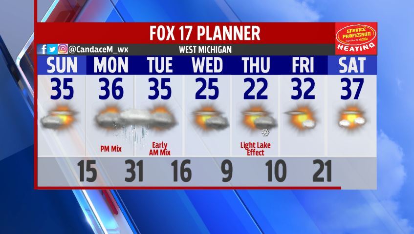


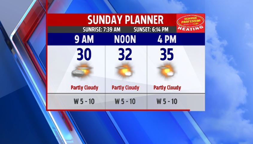
GRAND RAPIDS — West Michigan woke up Sunday morning with some cloud cover. We will slowly break away some of those clouds and manage to see sunshine before the day is done. Temperatures rebounded and are feeling better for the day as we started off in the upper 20s and lower 30s and will end up in the middle 30s. Winds have relaxed which will make us feel like our actual temperatures.
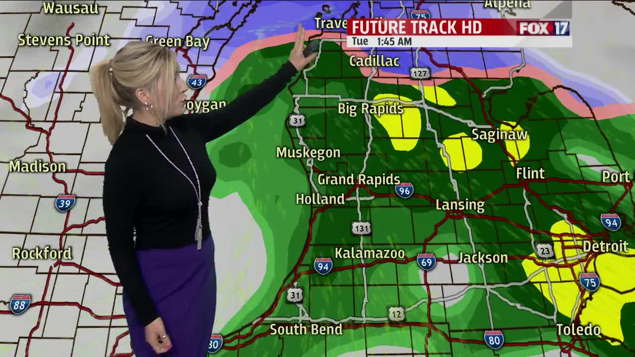
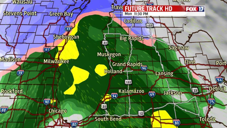
Monday morning will start off dry and we will see increasing cloud cover throughout the day. Late in the evening and at the earliest late afternoon we will see a rain/snow mix move in. I think it will be mainly rain with some wintry mix with any possible minor accumulations of snow would be along and north of I-96. This system is expected to bring minor impacts but can linger into Tuesday morning leaving some possible slick and slippery spots for your morning commute.
The middle of this work week will drop temperatures back into the 20s with minor lake effect snow chances. Otherwise a very calm week with sunshine and temperatures in the 30s to look forward to for Friday and Saturday.