


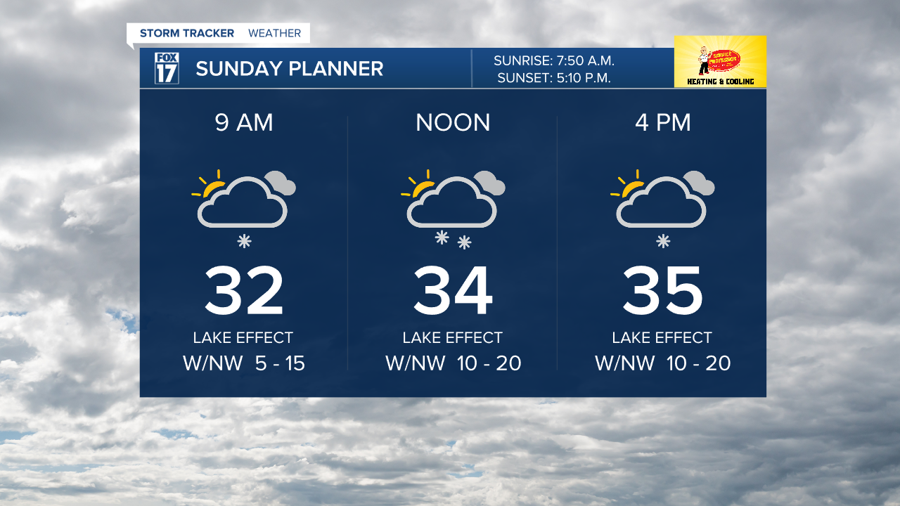
GRAND RAPIDS — West Michigan is starting off our Sunday with snowy roads especially on the side roads and on and off ramps to the highways. The highways should travel fine but it will take time throughout the day to clear all the side roads. Drive slow and be careful! We expect another round of snow today in a lake effect style with minor additional accumulations of a dusting to an inch of snow. Breezy winds out of the northwest leaving our daytime high temperatures in the 30s to feel like the 20s.
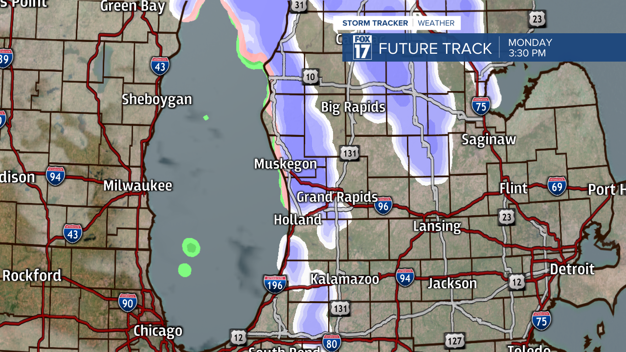
Monday we plan on another clipper system moving in with mostly snow showers and a bit of wintry mix possible as well. If you have dry time plan on mostly cloudy skies. Minor accumulations expected with 1 to 2 inches of snowfall possible mainly along and north of I-96 with a dusting expected southward.

By mid-week any and all snow we have gained will melt or wash away as we can plan on a warm-up with rain chances. Forecast models still aren't agreeing on the rain chances and timing of it, but currently looks like rain will move in late Wednesday and continue throughout Thursday. Temperatures push towards 50 degrees on Thursday too!

