WEST MICHIGAN – West Michigan will start off Sunday with cloudy skies and lingering snow showers moving north to south. This will be the trend throughout the day as snow showers slowly shut off. We could see a decent snow squall set up around the I-94 area later this afternoon which could give the most additional snowfall. Temperatures are bitter cold in the teens and 20s feeling like the single digits and even below zero once you factor in the breezy westerly winds. BUndle up! We will slowly shut off the snow throughout the day.
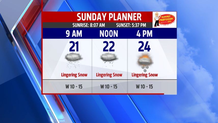
Winter Weather Advisories stay through the afternoon and evening. The latest ending times are for our southern communities who can see the most additional snowfall this afternoon from a possible snow squall setting up anytime around 1-3 o'clock.

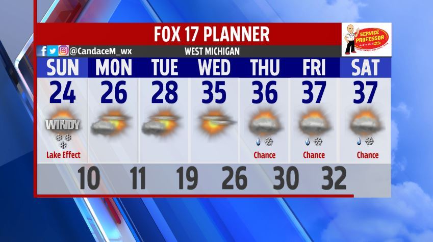
We will stay dry and cold during the first half of the work week before warmer air returns and we start to see more rain/snow mix chances. The Climate Predication Center even is pushing us into above average temperatures for the next 8-14 days.

We start to see these warmer temperatures by Wednesday with those rain/snow mix chances by Thursday. Check back later in the week for more details on any rain/snow mix chances after our few days of dry and partly sunny conditions.