


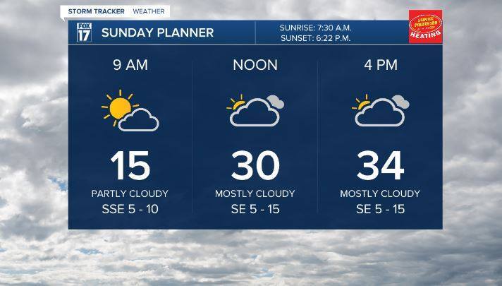
GRAND RAPIDS — Sunday morning kicked off with bitter cold temperatures an d some sunshine before we expect to increase our cloud cover through the day leading into snow showers expected this evening. Temperatures finally will be seasonable working into the lower 30s right about where we should be temperatures wise this time of year.
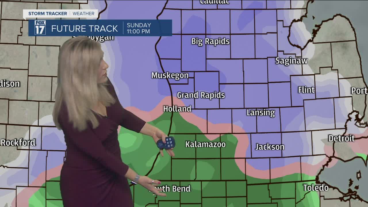
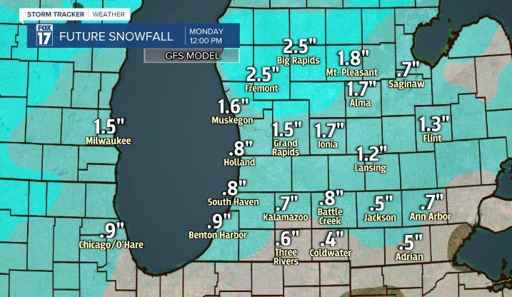
After sunset this evening we will see widespread snow move across West Michigan and stay with us through early Monday morning. This is expected to be more of a wet slushy snow when compared to our last couple events where we had a more light and fluffy snow. We can have even some rain/snow wintry mix work in especially south of I-96. We expect to see 1-3 inches of snowfall by Monday morning. Give yourself extra time Monday morning to assess the situation before heading out the door. Overnight our surface temperatures will hoover around 30 and 32 degrees which will pose some challenge with the snow accumulations but then also could freeze any moisture on the roadways.

Once we get past the snow we can look forward to a brief warm-up this week! Tuesday and Wednesday we can have temperatures in the lower 40s! Enjoy the warmth while it lasts before colder air works back in at the end of the week.


