


WEST MICHIGAN — The National Weather Service has issued a tornado watch Saturday until 8 p.m. for much of West Michigan including from Kalamazoo to Grand Rapids.
A couple of tornadoes, scattered hail up to quarter size, and winds up to 70 mph are possible. Flooding, especially on streets and low-lying areas, is expected.
The tornado watch covers parts of Illinois, Indiana and Michigan until 8 p.m. and wind damage to trees, power lines.
A tornado watch has been issued for parts of Illinois, Indiana and Michigan until 8 PM EDT pic.twitter.com/cyGWSWazjg
— NWS Grand Rapids (@NWSGrandRapids) June 26, 2021
A line of developing strong thunderstorms will bring gusty winds, heavy rain, with it as it moves into Southwest Michigan within the next hour or so. Isolated tornadoes are not out of the question with these storms.

Models are indicating the greatest threat to be in the time frame of 2 p.m. until 10 p.m. tonight. Believe it or not, the more sunshine and heat that builds in today could lead to stronger storms this evening. The heat from the sunshine can lead to greater instability, which could develop severe storms. Today is a "weather aware" day. Please have several ways of receiving severe weather alerts.
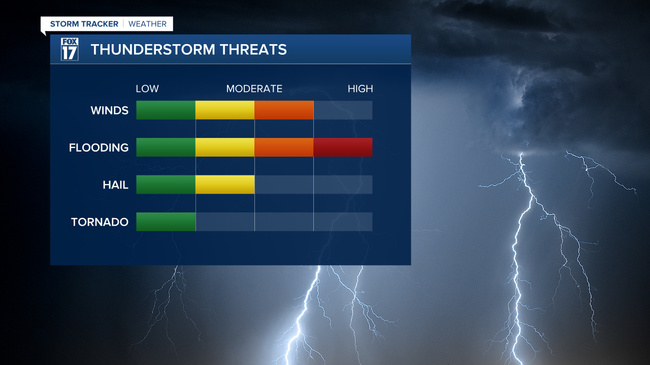
With the amount of rainfall that West Michigan has received within the last 48 hours, our ground is extremely saturated. The saturation somewhat softens the ground, which could lead to downed trees and downed limbs as gusty winds develop.
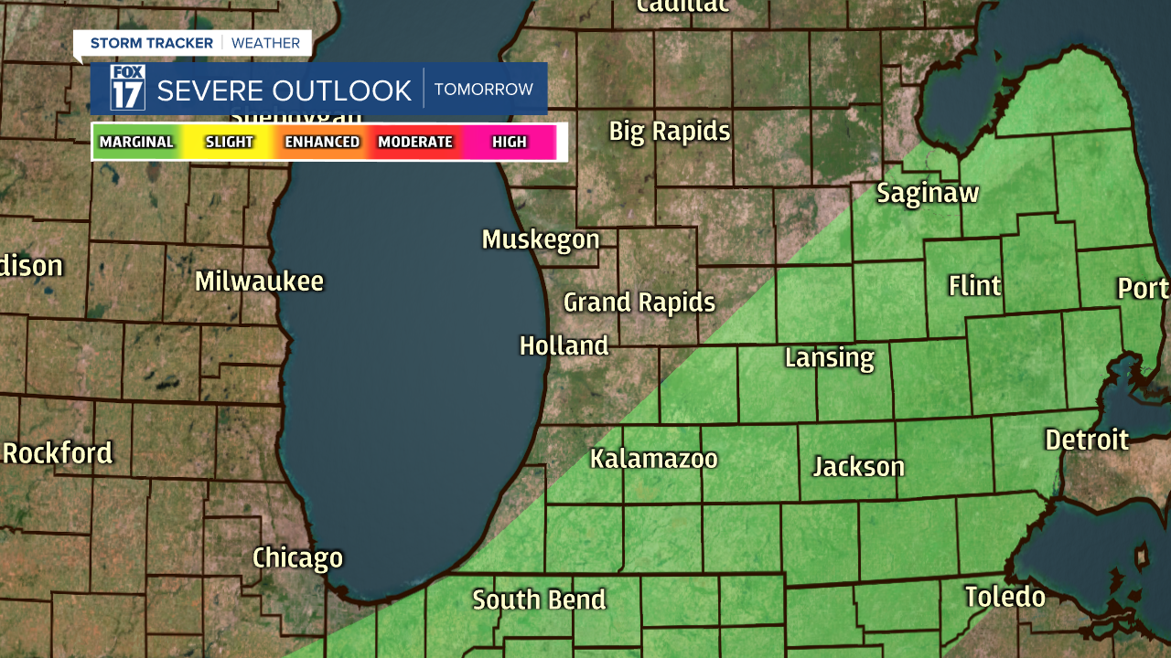
The severe weather risk continues into tomorrow, but it is a much lower threat. West Michigan falls under a marginal risk for severe weather on Sunday.
Showers and storms remain in the forecast every single day during this extended forecast.

