


GRAND RAPIDS — West Michigan woke up to light snow showers Saturday morning with arctic air still giving us freezing temperatures. Winds remain breezy making our temperatures feel that much colder plus gives us blowing and drifting snow through the entire weekend. We will see a bit of a lull in activity today, but it will be brief. A stray snow shower or two can't be ruled out this afternoon, but more widespread snow shows up this evening.

Widespread snow and possible lake enhancement should arrive around 5-7 o'clock this evening and stay with us through the overnight hours and into at least the first half of the day on Sunday. By early Sunday morning we expect to see an additional 2-4 inches of snowfall. Travel safely as visibility can be reduced plus blowing and drifting snow will still be a factor.


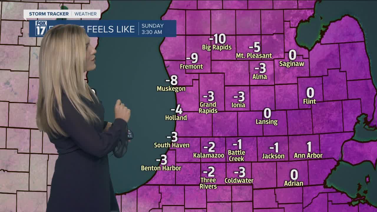
While we have all this snow we will continue to feel bitter cold. If the arctic air wasn't enough once we put the breezy winds into account we feel much colder. In fact, all day on Sunday our temperatures will feel like we are below zero especially in the morning hours. Bundle up and limit your time outside!

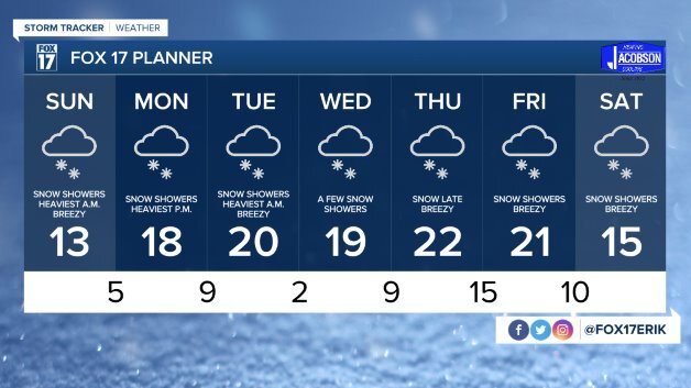
We will continue to see on and off again snow showers through the next 7 days adding inches of snowfall layer by layer to our growing snowpack. check back often for updates and timing of snowfall.