


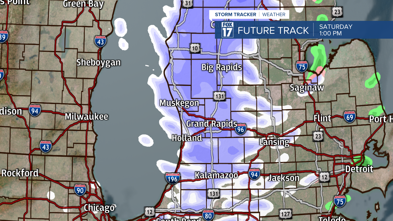
GRAND RAPIDS — West Michigan will have our daytime high early in the day as temperatures drop from the 50s to 40s and 30s throughout your Saturday. Winds will be the main focus as wind gusts can push upwards of 60 mph. Make sure all your devices are charged as power outages are possible. Rain will transition to snow by the afternoon leading to minor accumulations.

Wind gusts have already started to knock out power with gusts possible upwards of 55 to 60 mph. All of West Michigan is under a wind advisory through 7 o'clock this evening with portions under a high wind warning until 10 o'clock this morning and noon. Stay weather aware with these high winds all day. There will still be a breezy around on Sunday just not as strong, it will take until Monday for winds to completely relax.

Rain will change over to snow by late morning and early afternoon. We expect minor accumulations from this of an inch or less since our surface temperatures will remain above the freezing mark while we have this snow. We dry out quickly around late afternoon and early evening as this system continues to push away off to our north and east.
Sunshine and partly cloudy skies return to end the weekend and start next week with warmer temperatures on the way. The climate prediction center for the next 8 to 14 days continues to put us in above average temperatures right before our Christmas holiday. The chances of a white snowy Christmas continue to dwindle.

Temperatures near 60 degrees by mid-week along with rain chances for Wednesday and Thursday.

