


GRAND RAPIDS, Mich. — While West Michigan is expected to stay dry for the most of Saturday, conditions will quickly change overnight. A low pressure system is tracking into West Michigan overnight Saturday and into Sunday morning. This system is not expected to bring any severe weather, but a few rumbles of thunder and heavy rainfall will be possible.
The system pushes into Southwest Michigan first, gradually moving north through the day on Sunday. By 5:30 a.m. Sunday, rain showers will develop along I-94.

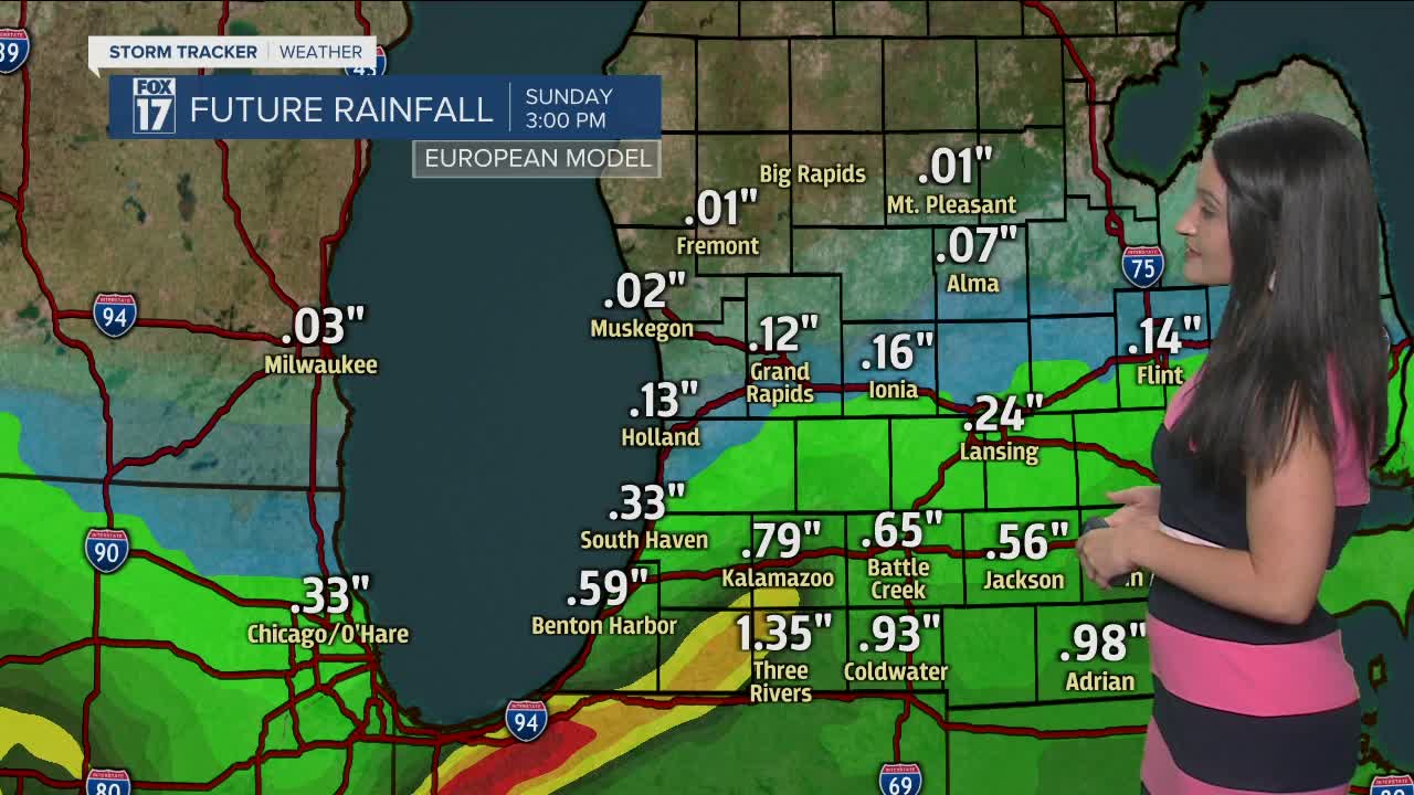
This is a slow-moving system for the second half of your weekend. By Sunday evening, locations along and south of I-96 are expected to see showers.
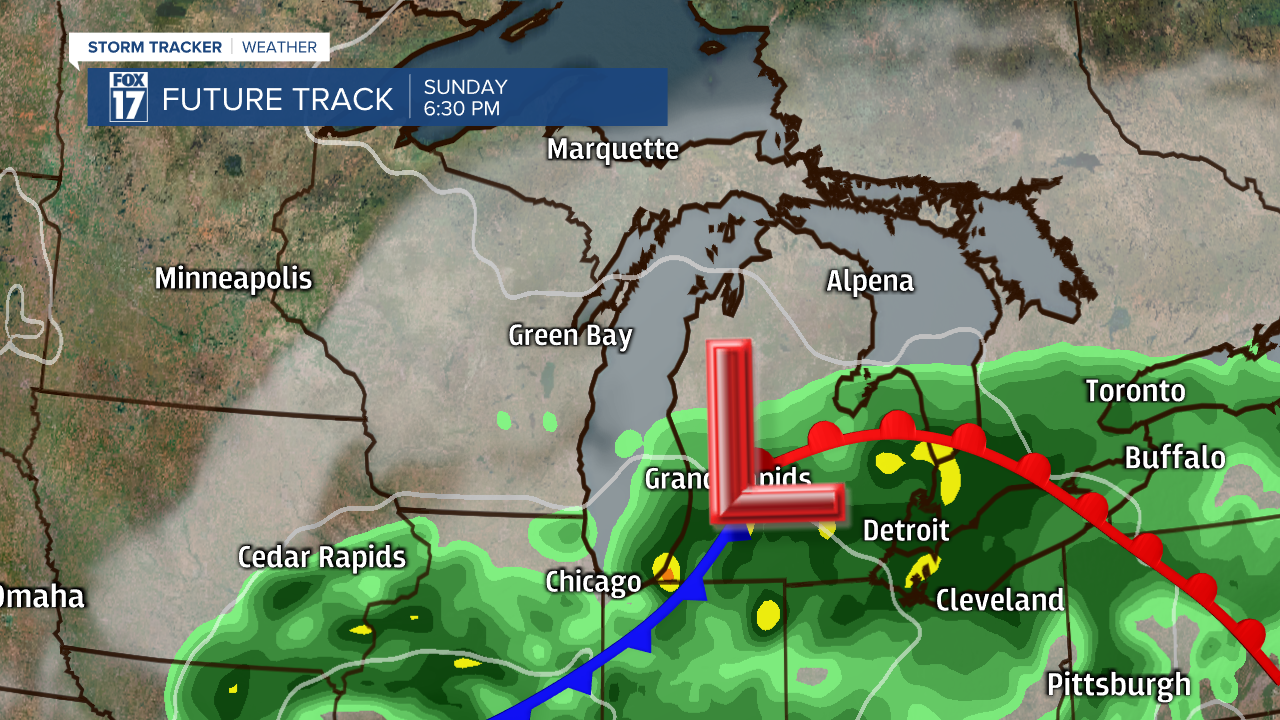
The same low pressure system will rotate over Michigan Sunday, Monday, and Tuesday. This will lead to potentially high rainfall totals. Between Sunday and Monday, parts of West Michigan could receive between two to three inches of rainfall. As of now, models are indicating the most precipitation in Southwest Michigan.

As this system tracks through your backyard, stay tuned with FOX 17 for rainfall updates.
