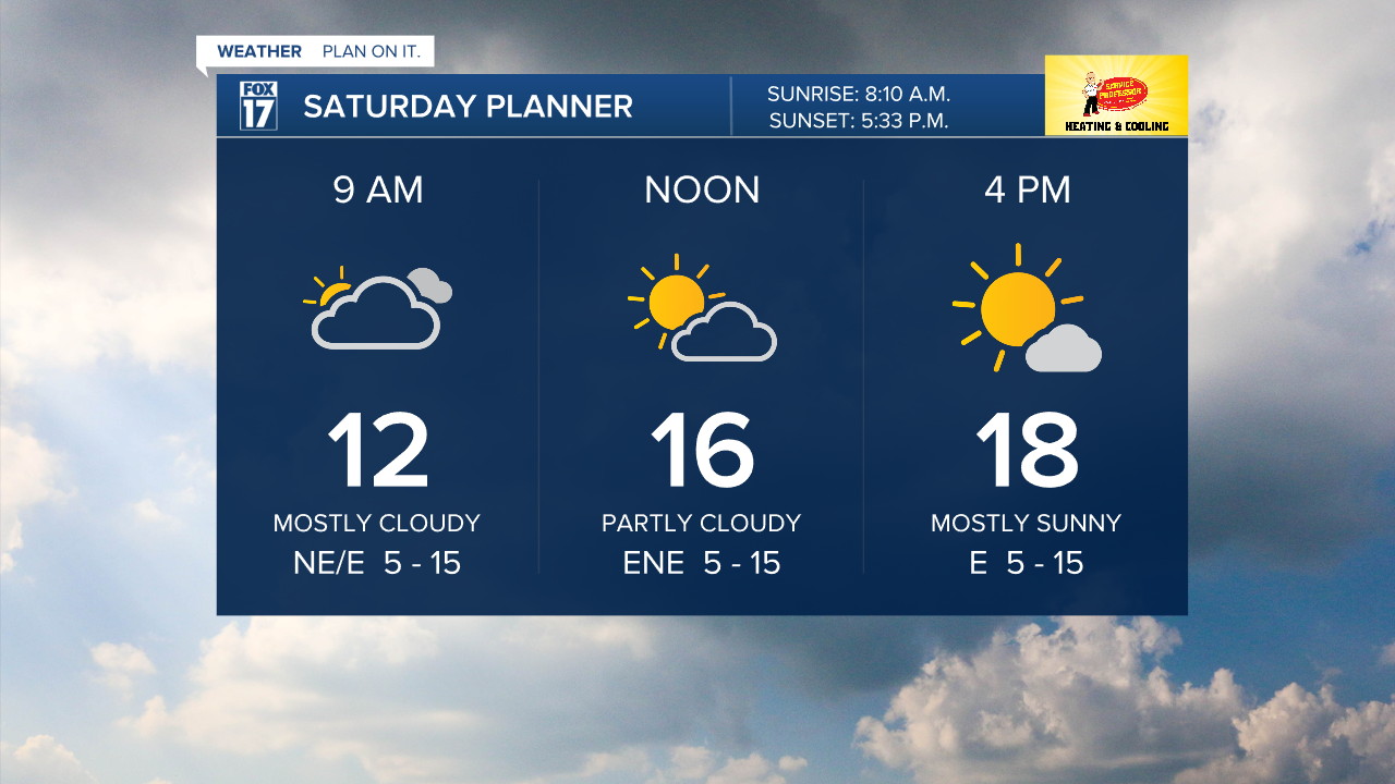
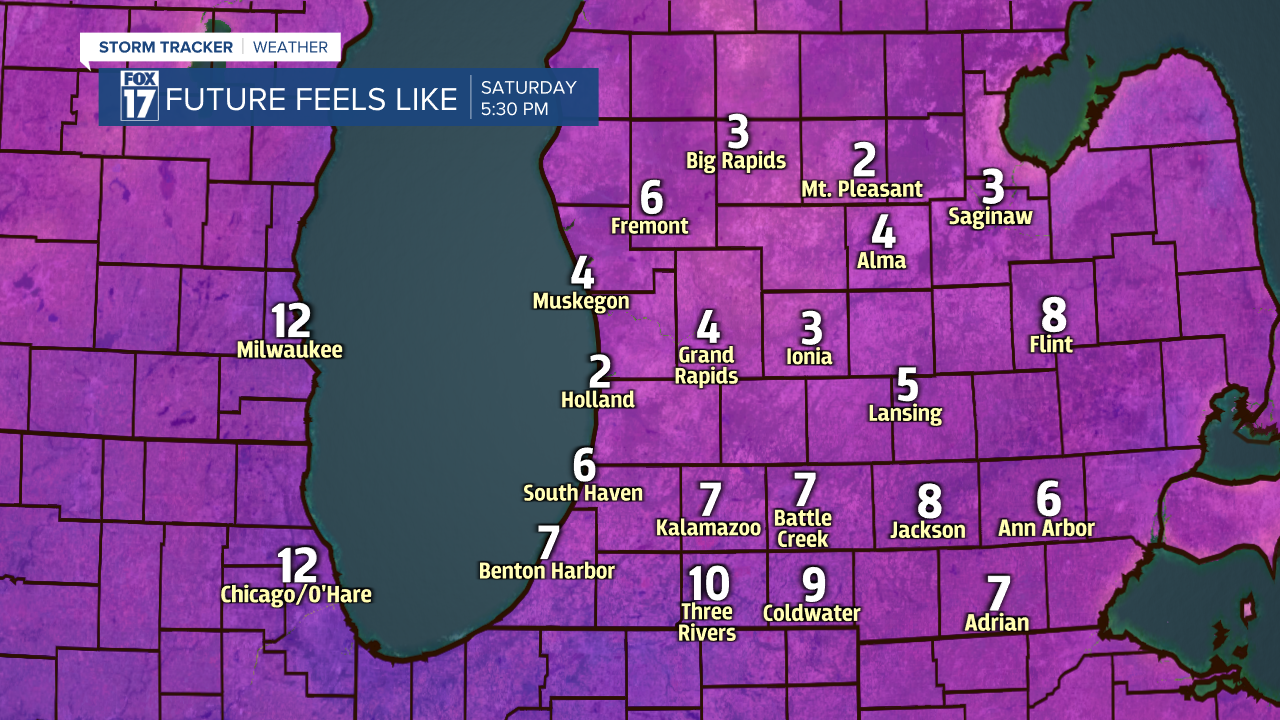
GRAND RAPIDS — West Michigan will be frigid this weekend! Temperatures only working into the teens for the afternoon and feeling like the single digits all day once you factor inn our breezy east northeast winds. We will have plenty of sunshine though as Canadian high pressure settles in. Bundle up to enjoy the sunshine!
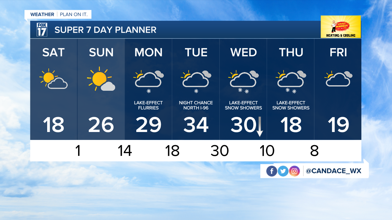
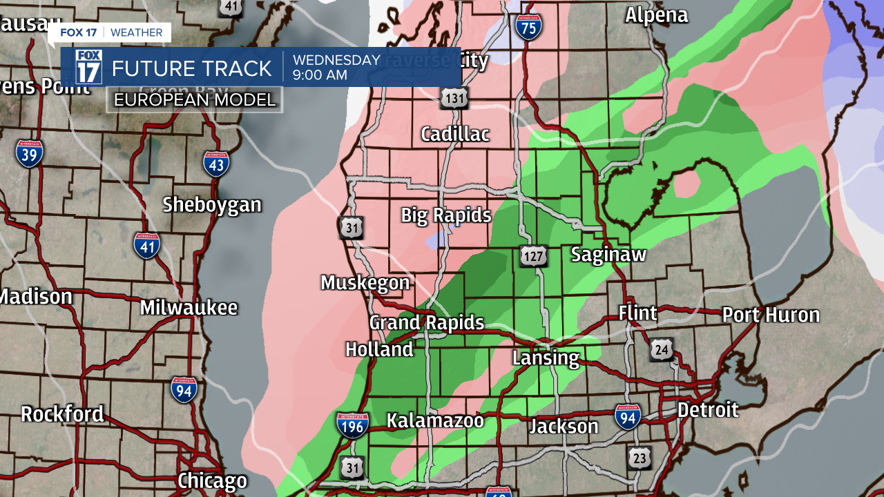
We will hold on to sunshine through the weekend with cloud cover building back in after sunset Sunday. Light lake effect flurries will be around on Monday as we keep a clipper system well to our north on Tuesday. Wednesday and Thursday we will have lake effect snow with our northwest wind flow. The beginning of this lake effect snow will have a bit of rain and wintry mix before we kick on the snow machine which can give those lake effect communities a few inches of snowfall by the end of Thursday.

Arctic air is here this weekend and then we rebound back into the 20s and 30s but now for long. Wednesday temperatures fall as arctic air comes rushing back inn to put our daytime highs back in the teens. Bundle up!