


WEST MICHIGAN — We are waking up Saturday morning to a more comfortable air mass with cooler temperatures on tap for the entire weekend. Enjoy a mix of sun and clouds as we have high pressure off to our west that will stay nearby for the next day or so. Winds can be breezy at times out of the NW anywhere from 10 to 20 mph.

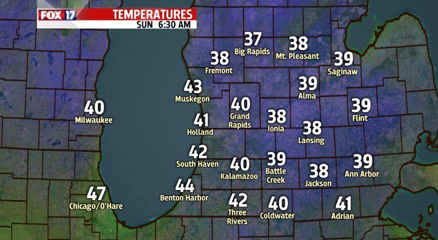
Overnight tonight we will cool off to temperatures in the lower 40s and possibly upper 30s. We have the potential for frost mostly in central lower Michigan. We have a record low set back in 1966 of 36 degrees for Grand Rapids and will be flirting with that record line as temperatures fall. I don't think this will impact agriculture in a huge way, but if you are concerned at all plan ahead and take the needed precautions.
After a mix of sun and clouds this weekend we will start to see rain chances work back into our forecast by late Monday closer to sunset hours. Rain chances will continue through Wednesday with the best bet for any showers and storms on Wednesday. Over the course of the 3 days we could pick up a quarter to a half an inch of rainfall with some of you maybe picking up an inch. We will keep you updated as we get closer.

Our heat will return as we head into next week. We will push back into the upper 70s and 80s ending next week with more sunshine.

