

WEST MICHIGAN -- Just when we thought Fall arrived in full force with crisp nights and sunny, mild afternoons, summer will briefly make a return to the area tomorrow and tomorrow night. Temperatures won't be all that far above average, but humidity will reach uncomfortable levels tomorrow with dewpoints in the middle to upper 60s. This humidity -- along with an approaching cold front -- will set the stage for a round of thunderstorms which could be strong to severe.
Here is the cold front as of this writing:

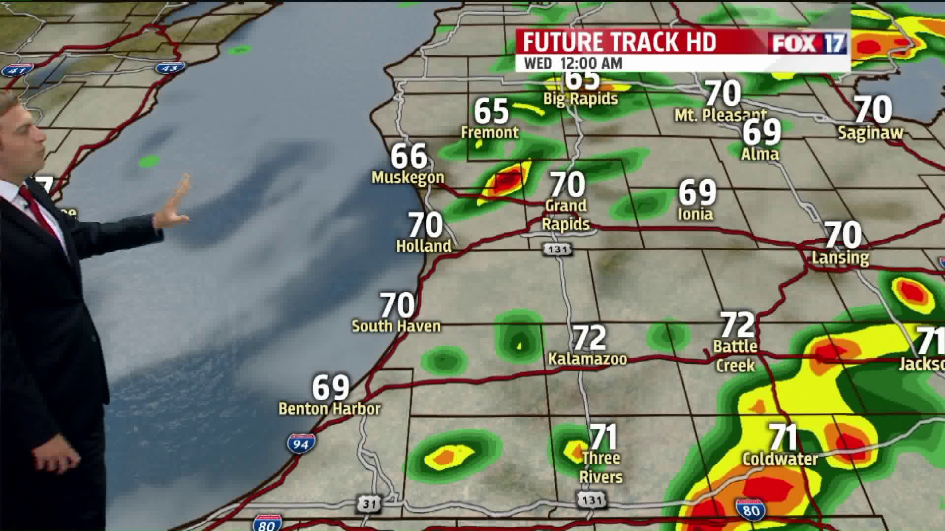
As that front approaches late Tuesday afternoon and Tuesday night, showers and thunderstorms will advance eastward from the Plains into West Michigan. The primary window for strong to severe thunderstorms will be from 5:00 PM Thursday to 2:00 AM Wednesday. This is what Future Track HD shows at 11:00 PM:

Although this forecast model doesn't show a lot of thunderstorm activity, it's possible we see more than what it's showing. If we get enough sunshine, conditions will be right for severe thunderstorms with strong forcing (due to that cold front), ample moisture, and favorable upper level wind dynamics. In fact, the Storm Prediction Center (SPC) has the entire FOX 17 viewing area in a Slight Risk for severe weather:

The primary threat with any severe storms that develop look to be straight line winds in excess of 60 mph. Large hail will be a secondary threat, and an isolated tornado can't be completely ruled out as there will be some change in wind direction with height in the atmosphere.

The weather will quickly turn cooler and more stable on Wednesday as that cold front pushes eastward. Cool, comfortable weather will be with us for the rest of the week with highs mainly in the 60s, and lows mainly in the 40s to around 50°. More showers are possible on Saturday, but no additional severe weather is in the extended forecast. Stay tuned to FOX 17 for more information!
