
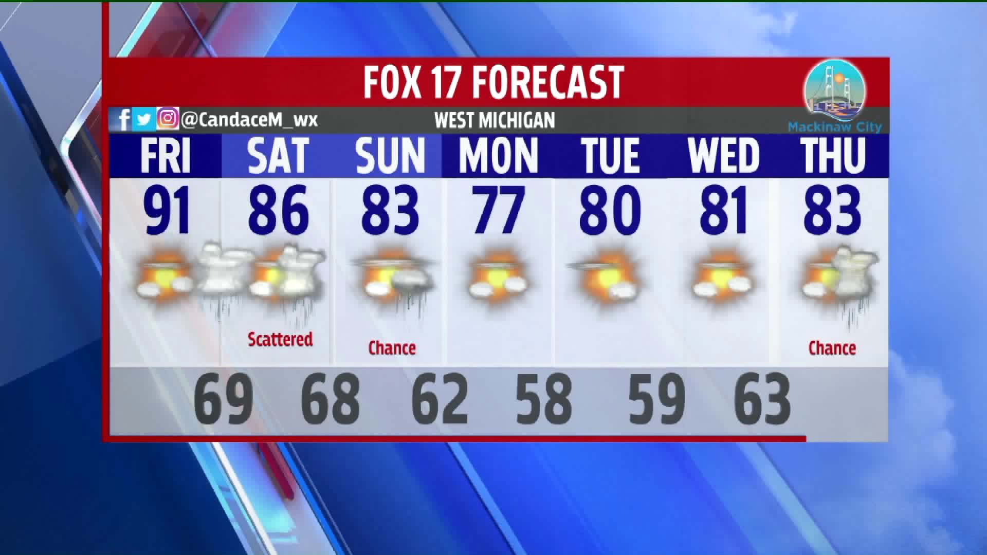


WEST MICHIGAN – We will continue to keep a partly cloudy sky in West Michigan for the daylight hours on Friday. Heat and humidity remain in place with temperatures reaching up into the 90s and dewpoints in the 60s and 70s. Showers and storms are expected to work into the area overnight anytime after 2:00 a.m.

West Michigan is in a slight risk for severe weather overnight Friday and into the day on Saturday with an approaching warm front. Folks in far southwest Michigan are in an enhanced risk for the same time frame. Showers and storms are expected to arrive mainly near and south of I-96 with heavy rainfall and the potential for wind gusts up to 30-50 mph. The biggest concerns with these showers and storms are flooding and damaging winds. The main area of showers and storms should leave West Michigan by lunch time Saturday, but there is a chance for redevelopment of a pop-up shower or storm in the afternoon and evening.


Shower and storm chances remain for Sunday with a low-pressure system slowly exiting West Michigan. We will see relief from the heat and humidity on Monday when temperatures drop back into the upper 70s. West Michigan will stay comfortable with partly sunny skies for the first half of the work week. Showers and storms become reintroduced on Thursday.

