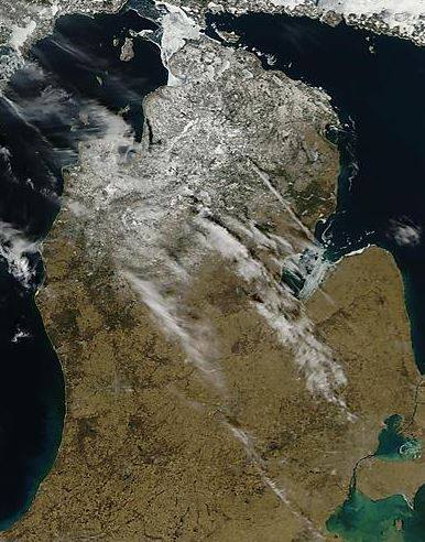
WEST MICHIGAN — It’s no secret that warmer temperatures this week have had a lot of people in Michigan scratching their heads as to what has caused this warm air, and also maybe wondering how this has compared to recent Februaries on record.
We’ll start with this date in February of 2015. The left image is a MODIS satellite image of the Mitten State two years ago. This is a high quality satellite image which depicts exactly what you would expect to see at this time of the year: snowpack.

In fact, climate averages for the month of February are relatively cold, with our monthly average temperature around 13 degrees, with nearly 20 inches of snow for the month.
Last February, we didn’t have a whole lot of snow either, but there was just a little bit of it on the ground, as you can see in the middle image. At least you’re able to see the ground surface, but there are still areas of snow and clouds present.

Last year was also a pretty warm February, with our average temperature topping out at nearly 30 degrees. Almost 15 inches of snow fell, which is fairly close to normal for the month.
This year proves to be quite a different story. Sunday was incredibly sunny and warm, with record breaking highs for the second straight day. Virtually no snowpack can be seen in the image on the right, except in areas of extreme northern Michigan.

Our average temperature so far is almost a degree warmer than last year.
At our current pace, it’s expected that we’ll see average monthly temperatures in the top three on record! If you wonder about the warmest February ever, it occurred in 1998 at 34.1 degrees.
Our lack of snow is probably the most glaring statistic. Will we see much more snow in February? Probably not. It’s likely that we’ll see another snow-producing system or two in March, but snowfall totals look to remain low for the remainder of the month.