
West Michigan – A storm system moving into the Great Lakes on Sunday will bring a chance of strong to severe thunderstorms. A Marginal Risk of severe weather is possible from Grand Rapids southward. That means the storms should be of limited coverage or marginal intensity.

Sunday 11 AM Future Track
Our computer model brings some showers and isolated thunderstorms into West Michigan by late Sunday morning.

Future Track for 5 PM Sunday
Showers and thunderstorms will increase into the afternoon hours with some isolated storms possibly becoming strong to severe. The thunderstorms will diminish later Sunday evening.
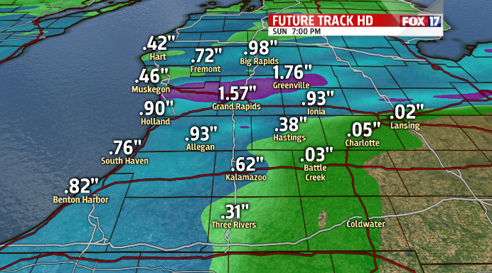
Future Track Rainfall Forecast
Rainfall amounts by Sunday evening could exceed an inch in some areas of West Michigan depending on the track of the storms.
For the latest Severe Weather Outlook check:
