
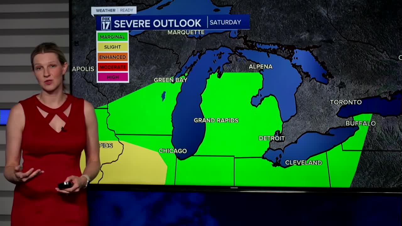


The forecast from FOX 17 Weather Ready Meteorologist Kara James: The FOX17 WEATHER READY ALERT DAY continues through the remainder of Saturday. Scattered storms are possible over the next few hours before a cold front arrives. A few of those storms could be strong to marginally severe at times with gusty winds or a brief spin-up tornado, along lightning and heavy rain. All of southern lower Michigan remains in a MARGINAL RISK (level 1/5) for the remainder of Saturday, but the timeframe for strong storm potential drops dramatically after around 9 p.m. We may be able to start seeing the Perseid Meteors in the coming days, but they don't peak until August 12/13. This is an annual event and stems from debris from the tail of the comet Swift Tuttle. Stay tuned to the FOX 17 Weather Ready Team for your latest forecast updates.
TONIGHT: Chance of an evening shower/storm. A few could be briefly strong before 9 p.m. Otherwise mostly cloudy. Lows in the mid 60s. Winds southwest/northeast at 5 to 10 mph.
SUNDAY: Some morning clouds, otherwise afternoon sunshine. Highs in the lower 80s. Winds northeast at 5 to 10 mph.
MONDAY: Mostly sunny to partly cloudy and pleasant. Highs in the low/mid 80s.
TUESDAY: Partly cloudy to partly sunny, warmer, more humid. Highs in the upper 80s.
WEDNESDAY: Partly sunny, hot, and humid. Slight chance of a shower/storm. Highs around 90.
THURSDAY: Partly sunny, hot, and humid. Slight chance of a shower/storm. Highs in the lower 90s.
For the latest details on the weather in West Michigan, head to the FOX 17 Weather page.
Follow FOX 17: Facebook - X (formerly Twitter) - Instagram - YouTube
