


WEST MICHIGAN — The forecast from FOX 17 Meteorologist Kara James: Temperatures will fall into the upper 20s overnight as clouds clear. Brr! Starting Wednesday, mainly dry conditions take over for West Michigan. Any systems will either be too far north, or too far south for any rain. Thursday night the system passing by could spark a few showers, but most stay dry. It will be mostly cloudy through the rest of the work week with only a few peeks of sunshine. The weekend will be a great one to be outside: mostly sunny and mild with highs in the mid 40s to around 50 degrees. There are no "major" storms are on the horizon until next week—we are watching the Thanksgiving timeframe closely! Stay tuned to FOX 17 for your latest forecast.
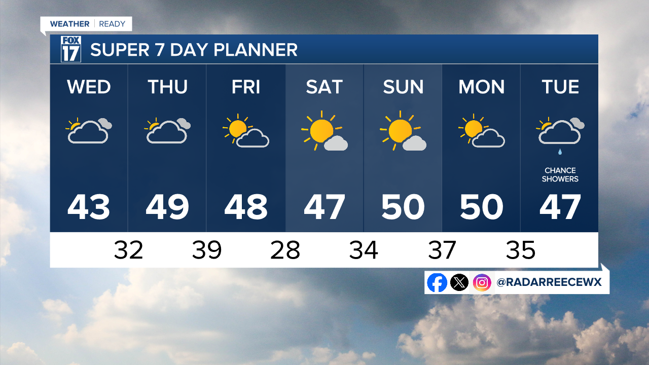
TONIGHT: Cold with decreasing clouds. Lows in the mid to upper 20s. Northeast wind 5 to 10 mph.
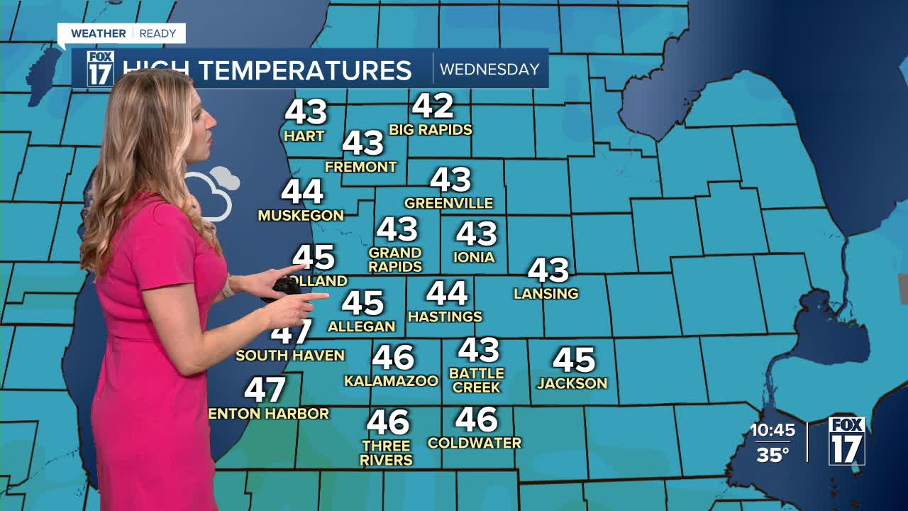
WEDNESDAY: Mostly cloudy with highs in the mid 40s.
THURSDAY: Mostly cloudy. Highs in the upper 40s. Stray shower possible late.
FRIDAY: Partly cloudy and mild. Highs in the upper 40s.
SATURDAY: Mostly sunny. Highs in the mid-upper 40s.
SUNDAY: Partly cloudy. Highs around 50.
MONDAY: Partly cloudy with highs around 50.
TUESDAY: Mostly cloudy with isolated showers late. Highs in the upper 40s.
For the latest details on the weather in West Michigan, head to the FOX 17 Weather page.
Follow FOX 17: Facebook - X (formerly Twitter) - Instagram - YouTube
