
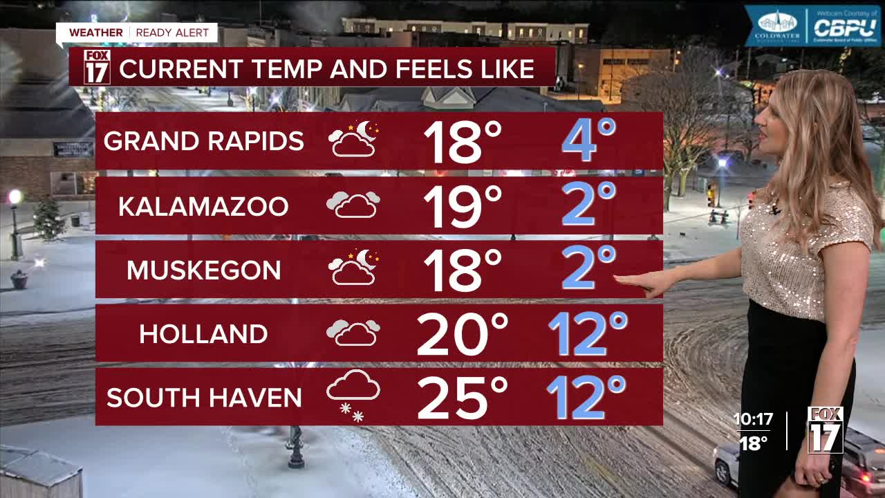


WEST MICHIGAN — From Fox 17 Weather Ready Meteorologist Kara James: Snow has ended for most, but slick roads, breezy winds and cold Arctic air remains throughout West Michigan. Be careful traveling for New Year's Eve festivities! A WINTER WEATHER ADVISORY continues for Oceana, Muskegon, Ottawa, Allegan, Kalamazoo and Van Buren Counties through 7 a.m. New Year's Day. It will be a very cold start to the New Year, with highs tomorrow around 20 and wind chills at times below zero! Another quick burst of snow Thursday afternoon could add another inch or so to our snow totals for the season, with limited travel impacts expected. Arctic air lingers through the weekend, with highs staying in the low to mid 20s and wind chills around 10 degrees colder. No significant systems are looming on the horizon, and a warmup back to the 30s is coming next week.
TONIGHT: Snow showers ending. Frigid and breezy. Lows around 10, wind chills near 3. Winds: NW 10-20 mph
THURSDAY: (New Years Day) Very cold, with afternoon snow showers. Highs in the mid-upper teens. Winds: NW 5-15 mph
FRIDAY: Mostly Cloudy. Highs in the low 20s.
SATURDAY: Mostly cloudy. Highs in the upper 20s.
SUNDAY: Mostly cloudy. Highs near 30.
MONDAY: Mostly cloudy with morning snow showers. Not as cold. Highs in the low 30s.
TUESDAY: Mostly cloudy with afternoon rain showers. Highs near 30.
WEDNESDAY: Mostly cloudy Highs in the low 30s.
For the latest details on the weather in West Michigan, head to the FOX 17 Weather page.
Follow FOX 17: Facebook - X (formerly Twitter) - Instagram - YouTube
