
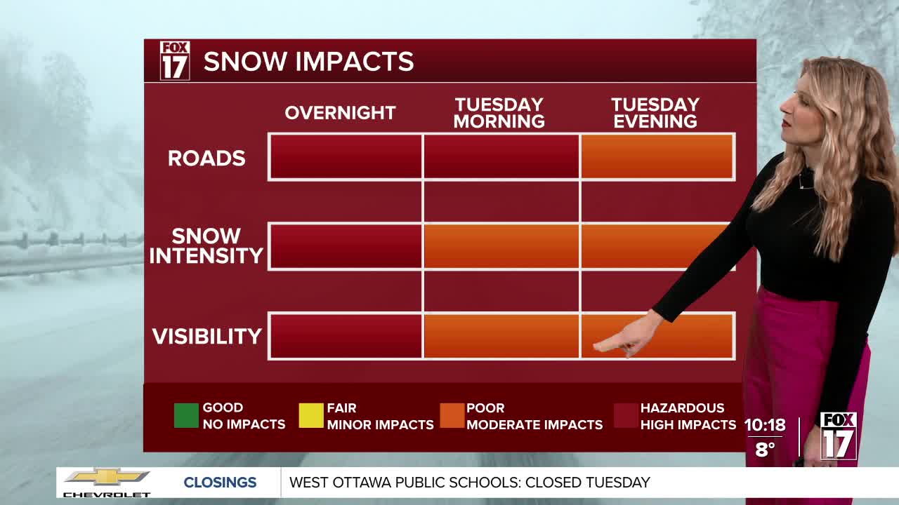


WEST MICHIGAN — From Fox 17 Weather Ready Meteorologist Kara James: Difficult travel is expected at times this week as continued rounds of lake effect snow combined with gusty winds will lead to very low visibility and blowing snow. It will also be extremely cold, as even colder air from the polar region slides into West Michigan. The WINTER STORM WARNING and WINTER WEATHER ADVISORY continue until 7AM Tuesday for most of West Michigan for another 1-3" of snow. Temperatures will drop into the single digits overnight, with wind chills dropping to -5 to -15. The coldest days this week will be Friday, Saturday and Sunday with morning temperatures around or below zero, with wind chills as low as -10 to -20. That is dangerous cold, and will be near record cold! Additional heavy snow comes with a low pressure system Tuesday night into Wednesday, with another 2-4" possible.
GRR FLIGHT TRACKER Here is the link to the Flight Tracker at the Gerald R. Ford International Airport. There are already several flight delays.
TONIGHT: WINTER STORM WARNING (Mainly US-131 to the West) WINTER WEATHER ADVISORY (Mainly East of US-131) (ending at 7AM Tuesday) Snow showers shift to lakeshore areas. Lows: 5-10 Wind Chills: -5 to -20
TUESDAY: Cold with light snow showers, and breezy. Highs in the teens. Wind Chills: 0 to -5
WEDNESDAY: Mostly cloudy with another round of snow (2-4" possible) Highs in the upper 20s.
THURSDAY: Cold with snow showers. Highs in the upper teens.
FRIDAY: Snow showers develop. Highs in the upper teens.
SATURDAY: Another round of Arctic air: Windy and colder with snow showers. Highs near 10.
SUNDAY: Another round of Arctic air: Windy and colder with snow showers. Highs in the low-teens
For the latest details on the weather in West Michigan, head to the FOX 17 Weather page.
Follow FOX 17: Facebook - X (formerly Twitter) - Instagram - YouTube
