
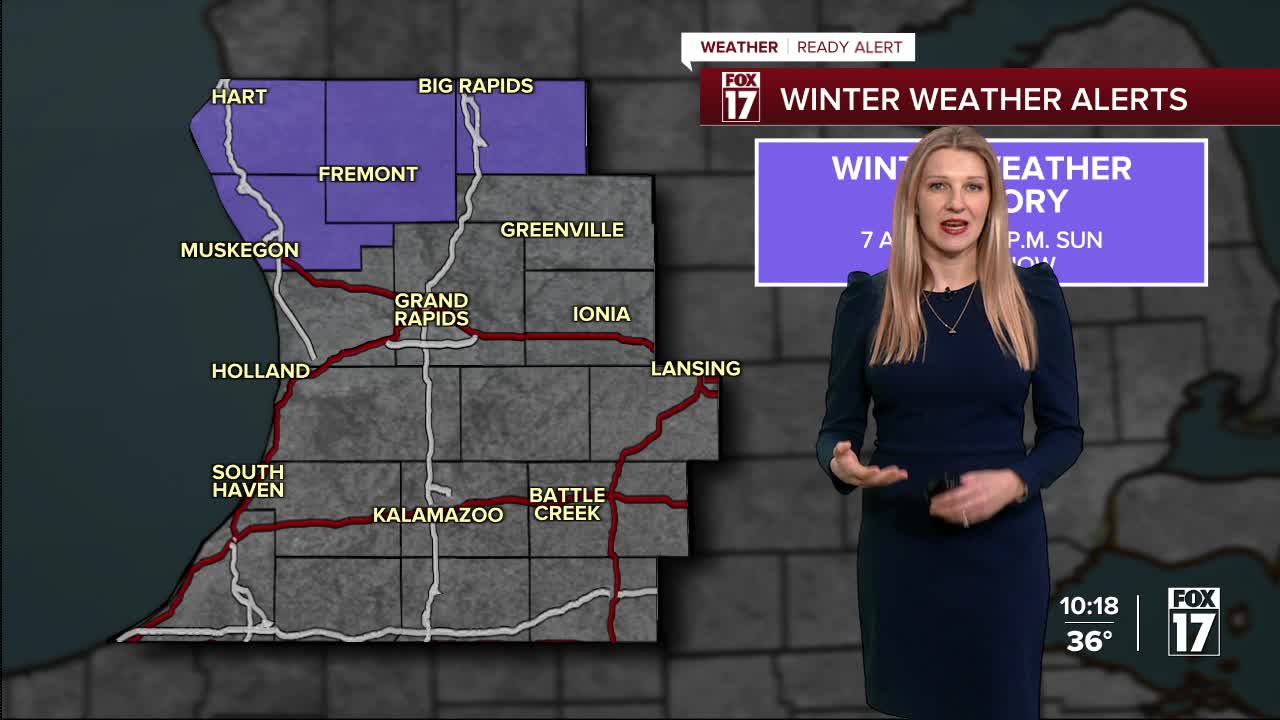


WEST MICHIGAN — From Fox 17 Weather Ready Meteorologist Kara James: After record-breaking temperatures this morning, much colder air has moved in to West Michigan and is here to stay for the weekend, as winter weather returns as well. Winds will die down this evening, and only 5 to 10 mph winds are expected overnight as clouds clear and temperatures drop into the 20s. A clipper system brings widespread snow showers Saturday, transitioning to lake effect snow on Sunday. There is a WINTER WEATHER ADVISORY from 7 a.m. Saturday through 1 p.m. Sunday for Oceana, Muskegon, Newaygo, and Mecosta Counties. A widespread 3 - 5" is expected, with isolated higher totals especially north / west of Grand Rapids. Snow will rapidly taper off after noon Sunday, but roads could still be slick in spots. It's going to feel like January next week too, with high temperatures slipping back into the 30s and chances for a wintry mix system Tuesday into Wednesday.
TONIGHT: Becoming partly cloudy. Cold and quiet. Winds relax. Lows: upper 20s. Winds: NW 5-10 mph
SATURDAY: Cold with widespread snow. Highs in the mid-30s. Winds: SW 5-15 mph
SUNDAY: Colder with snow showers, especially lake effect. Highs in the low 30s.
MONDAY: Partly to mostly cloudy. Highs in the mid-30s.
TUESDAY: Mostly cloudy with scattered rain/snow mix. Highs in the upper 30s.
WEDNESDAY: Chance snow showers. Highs near 30-degrees.
THURSDAY: Sharply colder. Highs in the mid-20s.
FRIDAY: Cold with highs in the upper 20s. Chance snow showers.
For the latest details on the weather in West Michigan, head to the FOX 17 Weather page.
Follow FOX 17: Facebook - X (formerly Twitter) - Instagram - YouTube
