


WEST MICHIGAN — The forecast from FOX 17 Meteorologist Erik Kostrzewa: High pressure will settle in tonight and tomorrow bringing decreasing clouds and chilly temperatures. A disturbance developing to our west Sunday morning will move eastward and impact us with a chance of rain and snow on Sunday night. Light accumulation is possible, with the best chance of that happening along and south of I-96. After the taste of winter is gone, spring temperatures return Monday and beyond.
TONIGHT: Becoming mostly clear and cold. Lows around 20. Northwest winds at 10 to 15 mph becoming northeast and subsiding to 5 to 10 mph late.
TOMORROW: Mostly sunny and chilly. Highs in the mid to upper 30s. Northeast winds at 5 to 10 mph.
TOMORROW NIGHT: Mostly clear during the evening, but becoming partly cloudy overnight. Lows in the lower 20s. East winds at 5 to 10 mph.
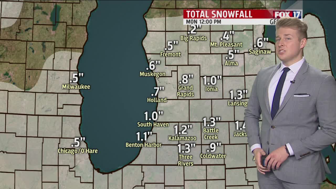
SUNDAY: Partly to mostly cloudy. A chance for light rain and snow showers after sunset. Highs in the lower to middle 40s. East to southeast winds at 5 to 15 mph.
MONDAY: Partly sunny skies. All snow will melt by the end of the day. Highs in the middle to upper 40s.
