
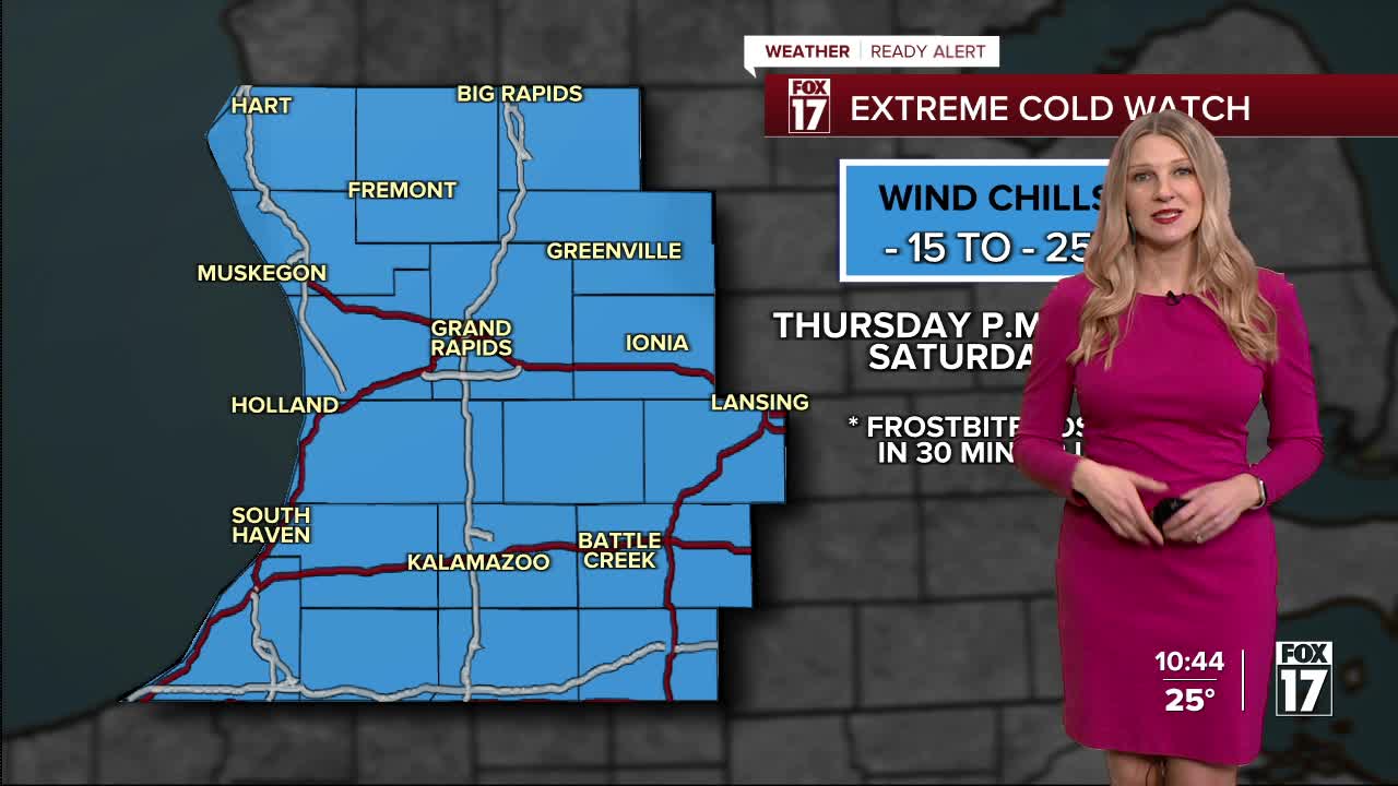


WEST MICHIGAN — From Fox 17 Weather Ready Meteorologist Kara James: Fresh snow and gusty winds will make travel challenging this evening, overnight and throughout much of tomorrow as road conditions will stay slick. Another Winter Weather Advisory has been issued for the lakeshore, Kent and Newago counties from 7 p.m. tonight through 7 p.m. Thursday, for 3-6" of snow. Gusty winds 25-30 mph will cause blowing snow and low visibility. Temperatures stay steady in the teens and low 20s, with wind chills around -5 to 5 all day. The real cold air sets in Friday with true Polar air sinking into the Great Lakes. Morning temperatures will be below zero Friday, Saturday and Sunday with single digit high temperatures. Wind chills will be as low as -10 to -20. That is dangerous cold, and will be near record cold!
GRR FLIGHT TRACKER Here is the link to the Flight Tracker at the Gerald R. Ford International Airport. There are already several flight delays.
TONIGHT: Widespread snow. Breezy. Lows in the teens.

THURSDAY: Cold with widespread morning snow, and snow again in the evening. Highs in the upper teens. Winds: NW 15-25 mph (Gusts to 30)
FRIDAY: Sharply colder. Snow showers develop. Highs around 8.
SATURDAY: Another round of Arctic air: Windy and colder with snow showers. Highs near 10. Lows: 0 to -10
SUNDAY: Another round of Arctic air: Windy and colder with snow showers. Highs near 10. Lows: 0 to -5
MONDAY: Not as cold. Highs in the low 20s.
TUESDAY: Mostly cloudy with highs in the low 20s.
For the latest details on the weather in West Michigan, head to the FOX 17 Weather page.
Follow FOX 17: Facebook - X (formerly Twitter) - Instagram - YouTube
