
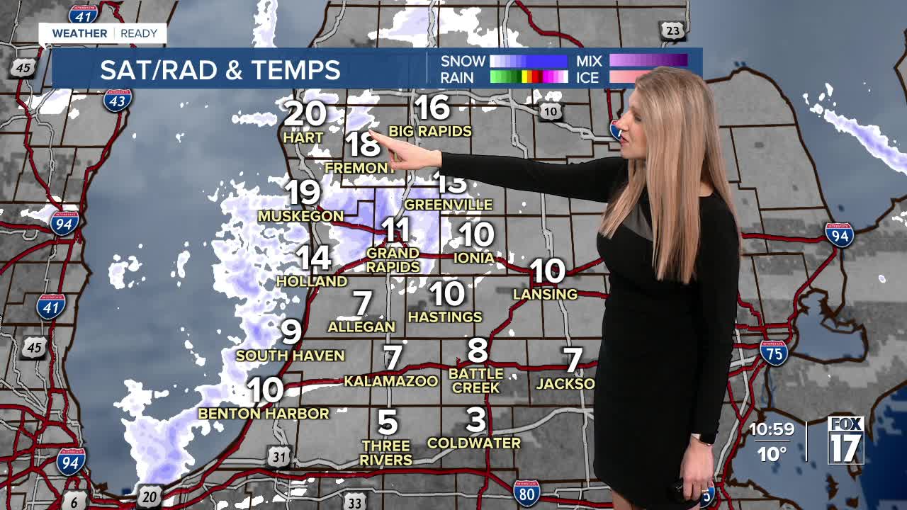


WEST MICHIGAN — From Fox 17 Weather Ready Meteorologist Kara James: Dry but cold conditions persist through the weekend, with plenty of sunshine during the day thanks to an Arctic high! Morning temperatures will still be cold, in the single digits overnight and below zero on Sunday morning. Without much wind, wind chills will be limited to -5 to -10 as the coldest. A few stray snow showers west of 131 are possible overnight, but will not result in more than half an inch to an inch of snow at best. Highs will be in the upper teens and low 20s this weekend. A few quick clippers next week bring occasional rounds of light snow. The first will be Sunday night into Monday, and with another system late in the week bringing more snow chances. Temperatures will be warmer, in the mid to upper 20s, with mornings in the teens or lower.
TONIGHT: Partly cloudy, stray snow showers possible. Another cold night. Lows around 3. Winds: N 5 mph
SATURDAY: Partly cloudy and cold. Highs in the upper teens. Winds: N 5 mph
SUNDAY: Partly cloudy. Highs in the low 20s.
MONDAY (GROUNDHOG DAY) Partly cloudy with chance snow showers. Not as cold. Highs in the mid-20s.
TUESDAY: Mostly cloudy with a stray snow shower. Highs in the mid-20s.
WEDNESDAY: Partly cloudy. Highs in the mid-20s.
THURSDAY: Mostly cloudy. Chance late day snow showers. Highs: mid-upper 20s.
FRIDAY: Mostly cloudy with chance snow showers. Highs in the upper 20s.
For the latest details on the weather in West Michigan, head to the FOX 17 Weather page.
Follow FOX 17: Facebook - X (formerly Twitter) - Instagram - YouTube
