


The forecast from FOX 17 Weather Ready Meteorologist Kara James: The "mid-summer" re-run across West Michigan continues for one more day, as a huge area of high pressure brings loads of sunshine and unseasonably warm air into the region. Our "average" highs for mid-September are in the mid-70s! That same high pressure will allow for clear skies and efficient cooling overnight, leading to patches of fog in the early morning. Tomorrow will warm into the mid 80s before a mainly dry cold front moves through in the evening. Slightly cooler air returns Friday and Saturday before a warm front Sunday nudges highs back into the 80s. That will also provide the best widespread rain chance of the week, although it isn't a slam dunk for rain. Humidity will be on the rise through the end of the weekend as well. Make sure to stay up to date with the FOX 17 Weather Ready Team for your latest forecast updates.

TONIGHT: Clear and comfortable. Lows in the upper 50s. Winds light.
THURSDAY: Mostly sunny to partly cloudy and warm. Slight chance of an afternoon shower from Grand Rapids north. Highs in the low/mid 80s. Winds southwest/west at 5 to 10 mph.
FRIDAY: Mostly sunny to partly cloudy and cooler. Highs around 80.
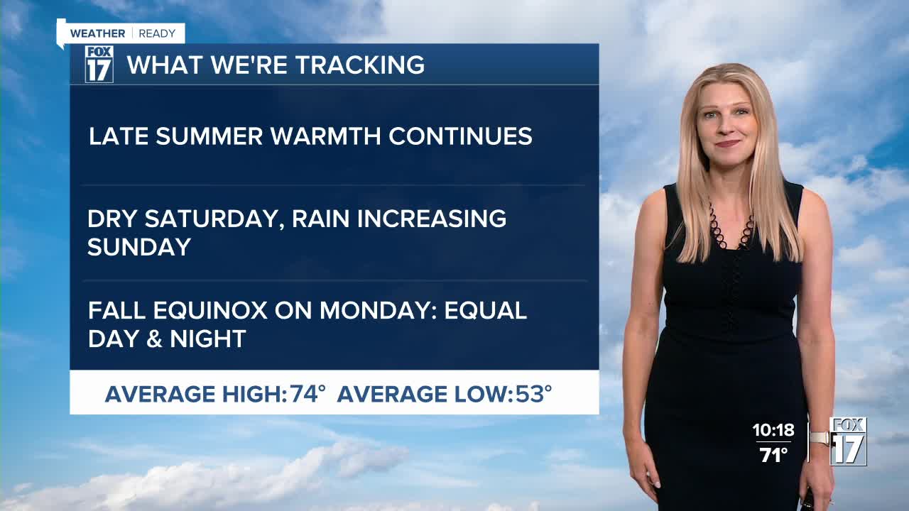
SATURDAY: Partly cloudy to partly sunny. Highs in the upper 70s.
SUNDAY: Partly sunny with a chance of showers, perhaps a thundershower. Highs in the lower 80s.
MONDAY (FALL EQUINOX arrives at 2:19 P.M.): Partly sunny, chance of showers. Highs in the upper 70s.
TUESDAY: Partly sunny with chance of showers. Highs in the mid 70s.
For the latest details on the weather in West Michigan, head to the FOX 17 Weather page.
Follow FOX 17: Facebook - X (formerly Twitter) - Instagram - YouTube
