


The forecast from FOX 17 Weather Ready Meteorologist Kara James: Tonight will be mostly clear and chilly, but not as breezy as the last few nights. Thursday will be dry but still breezy, with increasing clouds as a low pressure system passes to our east. Rain chances hold off until Friday as a wind direction change from the northwest helps start lake enhanced rain showers. Those will be isolated to scattered, but could impact your Halloween trick or treating! Scattered lake enhanced showers are also possible Saturday. No major storms are on the horizon for West Michigan anytime soon. Temperatures remain at or slightly cooler than average through next week, with high temperatures in the low 50s and mornings in the mid/upper 30s. Hurricane Melissa is setting its sight on Bermuda for potentially a third landfall before moving into the open Atlantic. Stay with the FOX 17 Weather Ready Team for your latest forecast updates.
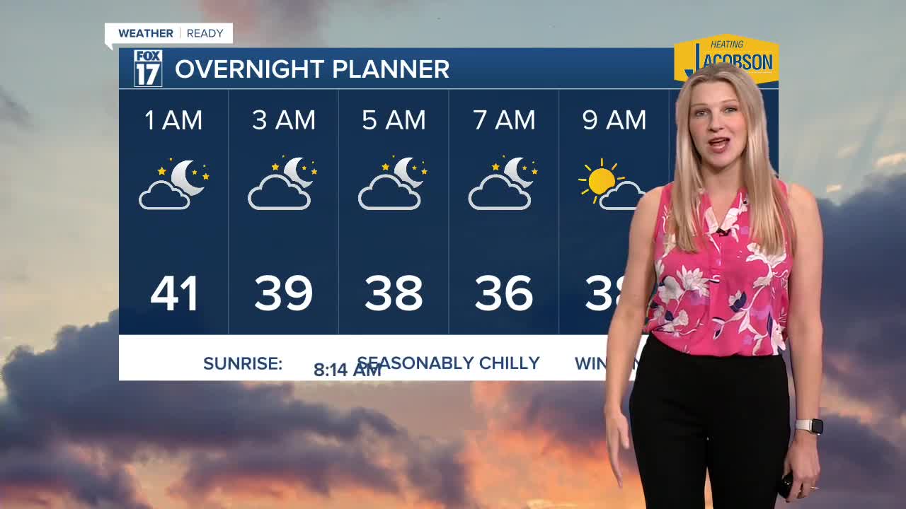
TONIGHT: Mostly clear and seasonably cool. Lows in the mid 30s. Winds northeast at 5 to 10 mph.
THURSDAY: Mostly sunny to partly cloudy. A little breezy. Highs in the lower 50s. Winds north at 10 to 15 mph.
FRIDAY: Partly sunny to mostly cloudy with a chance of light lake effect rain showers. Highs around 50.
SATURDAY: Mostly cloudy with a chance of showers. Highs in the upper 40s.
SUNDAY: Remember to "Fall Back" an hour at 2 a.m., as Eastern Standard Time Returns. Partly sunny to mostly cloudy. Chance of a shower. Highs around 50.
MONDAY: Partly sunny with a chance of showers. Highs in the lower 50s.
TUESDAY: Partly sunny with highs in the low 50s.
For the latest details on the weather in West Michigan, head to the FOX 17 Weather page.
Follow FOX 17: Facebook - X (formerly Twitter) - Instagram - YouTube
