
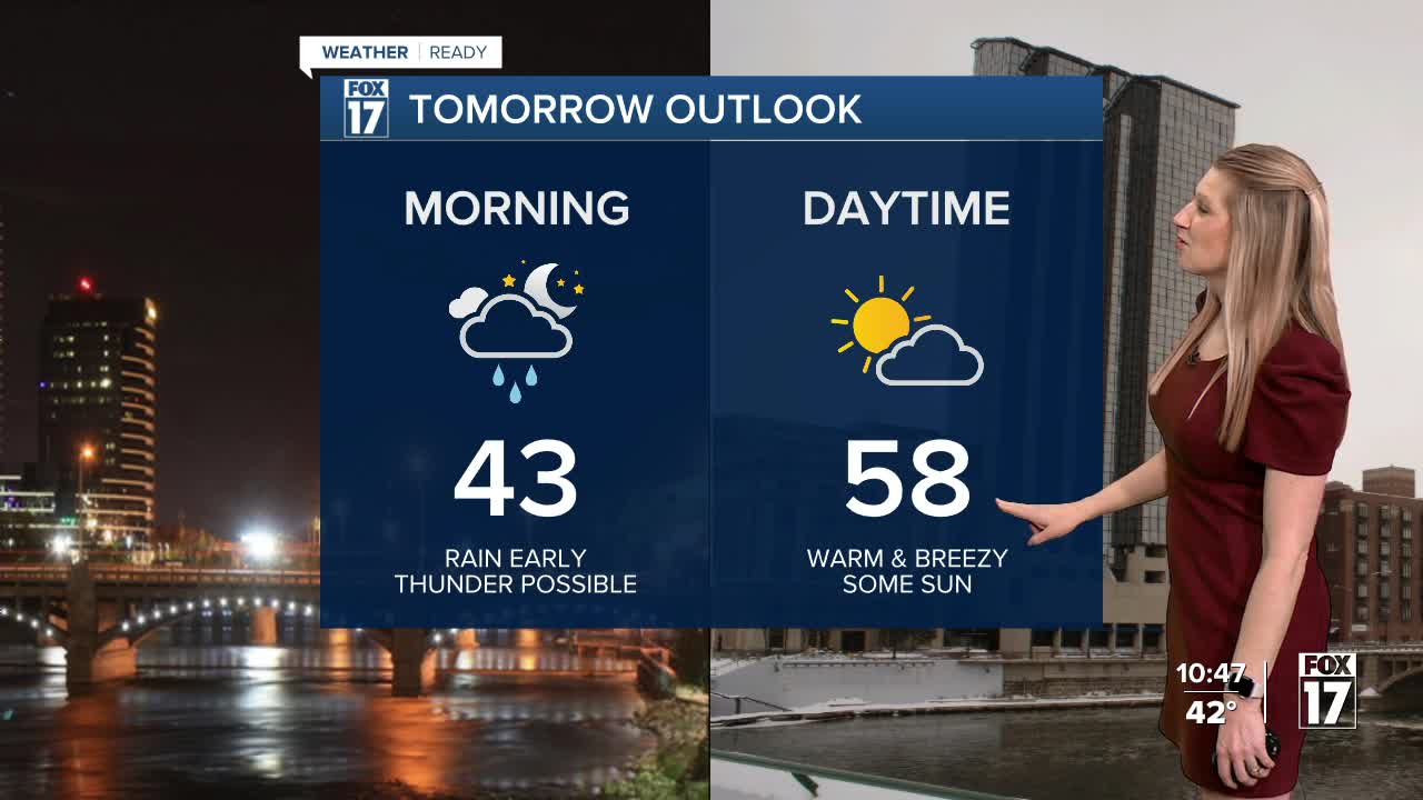


The forecast from FOX 17 Meteorologist Kara James: The first weather system this week arrives overnight, bringing rain showers from around midnight to mid-morning Wednesday along with a surge of warmer air. You may even hear a rumble of thunder! Rain totals will be around .25" to .50". We need a slow and gradual thaw to limit flooding concerns and gently thaw the ice on area rivers to prevent or mitigate ice jams. Rain moves out early tomorrow, with breezy southwest winds and highs soaring into the upper 50s. A few more rain showers are likely Thursday night as a secondary low pressure system arrives. There may be a mix or transition to rain/snow showers as temperatures fall on Friday into the lower/mid 40s. Cooler temperatures are expected by the weekend with highs falling back into the 30s with some lake effect snow showers possible. The longer range forecast models indicate that overall, we may see temperatures remain above normal into early March. Normal highs for this time of year have us in the mid 30s.
TONIGHT: Cloudy with rain showers likely...perhaps a rumble of thunder. It is possible some freezing rain may occur north/east of Grand Rapids across Newaygo and Mecosta Counties before warming enough to transition to all rain. Steady/slowly rising temperatures as a warm front lifts through the state. Lows in the lower 40s. Winds east at 10 to 15 mph.
WEDNESDAY: Morning showers. Dry in the afternoon, perhaps some late day clearing. Unseasonably warm! Highs in the mid/upper 50s. Winds southwest 10 to 20 mph.
THURSDAY: Partly cloudy to mostly sunny and mild. Rain showers developing in the late evening and overnight. Highs in the mid 50s.
FRIDAY: Mostly cloudy with the chance of rain/snow showers before noon. Highs in the mid 40s.
SATURDAY: Partly sunny to mostly cloudy and cooler. Highs in the mid/upper 30s.
SUNDAY: Mostly cloudy with a chance of snow showers. Highs in the lower 30s.
MONDAY: Partly sunny to mostly cloudy. Chance of snow showers or flurries. Highs around 30.
For the latest details on the weather in West Michigan, head to the FOX 17 Weather page.
Follow FOX 17: Facebook - X (formerly Twitter) - Instagram - YouTube
