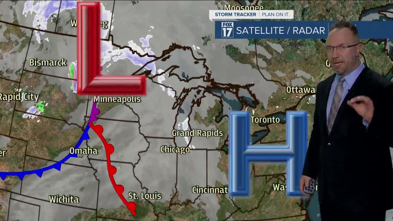
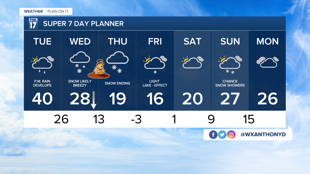
WEST MICHIGAN — WEST MICHIGAN — The forecast from FOX 17 Meteorologist Anthony Domol: We expect clouds to lower and thicken on Tuesday with light rain developing in the afternoon. This will transition to a brief wintry mix before changing to all snow later at night. We're tracking a storm system for Wednesday and Thursday, bringing snowfall to the region. The latest forecast models show this system tracking southeast of Michigan. That means colder air and several inches or more of snow accumulation likely along/south of the I-94 corridor and east toward Jackson, Ann Arbor, and Detroit. Make sure to stay up on later forecasts for updates as details will likely change. Difficult travel conditions are expected with this system. WINTER STORM WATCHES have already been posted from 2 A.M. Wednesday through 11 P.M. Thursday evening for Allegan, Barry, and Eaton County. WINTER STORM WARNINGS have been issued for Van Buren, Kalamazoo, and Calhoun counties to the south and east from 2 A.M. Wednesday through 11 P.M. Thursday.
TONIGHT: Partly cloudy this evening, becoming mostly cloudy overnight. A little breezy especially late. Lows in the low/mid 20s. Winds southeast at 10 to 15 mph.
TOMORROW/TUESDAY: Mostly cloudy, warmer yet. Highs in the upper 30s to lower 40s. Rain develops in the afternoon hours, then transitions to a wintry mix/snow overnight. Winds south/southwest at 10 to 20 mph.
WEDNESDAY: Snow showers, with the heaviest bands south and east of Grand Rapids. Highs in the upper 20s early Wednesday, then falling throughout the day.
THURSDAY: Light snow possible with the heaviest bands well south and east of Grand Rapids. Areas along/south of the I-94 corridor could be looking at total accumulations of 6-10+". Grand Rapids would be on the order of about 3" to 5" with the current track of this system. Further north of GR, less than 1" is likely. Temps in the upper teens early on dropping into the lower teens and single digits by day’s end.
For the latest details on the weather in West Michigan, head to the FOX 17 Weather page.


