
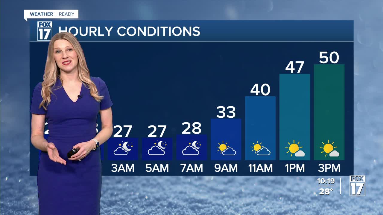


The forecast from FOX 17 Weather Ready Meteorologist Kara James: Overnight will be mostly clear and chilly with lows in the upper 20s. Tomorrow will be the warmest day of the week with highs in the low 50s and sunshine, but with a stiff breeze it will not feel as warm as last week. Saturday evening/night our next weather system arrives, with the chance for snow showers and reinforcing colder air. A widespread 1-3" is expected, with mainly accumulations on elevated and grassy spots. Roads could be a little slick in spots, but no major travel disruptions. Cold air lingers Sunday and Monday with a mix of sun and clouds, but warmer air starts to nudge in by mid next week. It will also become more active, with several chances for rain or a rain / snow mix. Longer range temperature outlooks still keep Michigan in at/above normal readings into the first full week of March and perhaps beyond. Normal highs are in the mid 30s.
TONIGHT: Partly cloudy, not as cold. Lows in the mid/upper 20s. Winds southwest at 5 to 10 mph.
TOMORROW: Mostly sunny to partly cloudy, breezy, and mild. Highs in the low 50s. Winds southwest at 10 to 20 mph with gusts up to 35 mph.
SATURDAY: Some morning sunshine, otherwise becoming mostly cloudy with evening/night snow showers. Accumulations of 1" to 3" possible. Highs in the mid 30s.
SUNDAY: Partly cloudy and cold. Highs in the upper 20s.
MONDAY: Partly cloudy. Highs in the lower 30s.
TUESDAY: Mostly cloudy and warmer. Highs near 40. Chance late day rain / snow mix.
WEDNESDAY: Partly cloudy to party sunny. Highs in the lower 40s. Chance late day rain.
THURSDAY: Mostly cloudy with chance rain / snow mix. Highs in the mid 40s.
For the latest details on the weather in West Michigan, head to the FOX 17 Weather page.
Follow FOX 17: Facebook - X (formerly Twitter) - Instagram - YouTube
