
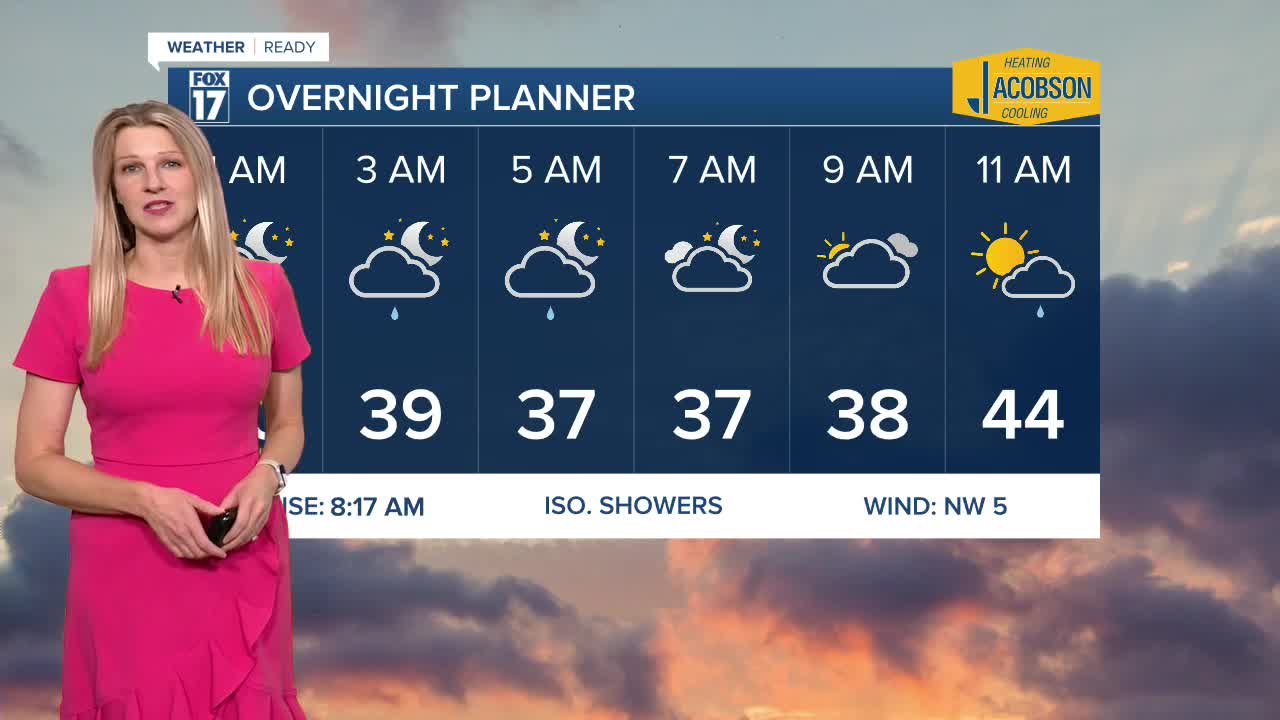


WEST MICHIGAN — The forecast from FOX 17 Weather Ready Meteorologist Kara James: After ending October with 7 rain days but still around 0.8" below where we should be, a few lake enhanced showers are possible overnight and during the first half of the day Saturday. No major storms are on the horizon for West Michigan, but a few clipper systems will bring isolated shower chances through the next week. Sunday will be the brighter half of the weekend, with sunshine and highs in the low 50s. A few showers are possible Monday, Wednesday and Friday as systems zip through. Rain totals will be light, around a quarter inch. Temperatures remain close to "average" through next week, with high temperatures in the low to mid-50s and mornings in the mid/upper 30s. Stay with the FOX 17 Weather Ready Team for your latest forecast updates.
TONIGHT: Scattered lake effect showers. Lows in the upper 30s. Winds: W 5-10 mph
SATURDAY: Partly sunny with scattered lake effect rain showers. Highs near 50. Winds: NE 5-10 mph
SUNDAY: Remember to "Fall Back" an hour at 2 a.m., as Eastern Standard Time Returns. Partly sunny. Highs in the lower 50s.
MONDAY: Morning clouds with a chance of showers, otherwise becoming partly sunny in the afternoon. Highs in the lower 50s.
TUESDAY: Mostly sunny to partly cloudy. Highs in the mid 50s.
WEDNESDAY: Partly sunny with isolated showers. Highs in the upper 50s.
THURSDAY: Partly cloudy. Highs in the low to mid 50s.
FRIDAY: Mostly cloudy with scattered showers. Highs in the mid 50s.
For the latest details on the weather in West Michigan, head to the FOX 17 Weather page.
Follow FOX 17: Facebook - X (formerly Twitter) - Instagram - YouTube
