
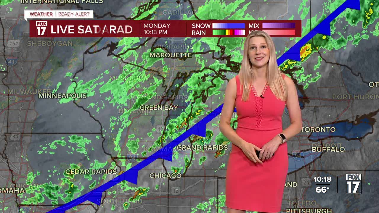


The forecast from FOX 17 Weather Ready Meteorologist Kara James: After a "Summer-like" weekend with plenty of sunshine and highs in the 80s (near record levels), a sharply cooler airmass will settle in this week. Rain showers and a few thunderstorms continue overnight and tomorrow morning along a cold front. The showers will come along with significantly colder air, dropping high temperatures into the "seasonable sixties" starting Tuesday and continuing through much of the week. With only one day of rain and aggressive drought conditions, there is also a growing concern for grass and brush fires, and expect it to worsen across West Michigan into mid-October. Areas of frost will be possible Wednesday night into Thursday morning. Make sure to stay with the FOX 17 Weather Ready Team for your latest forecast updates.

TONIGHT: Cloudy and with rain likely. Chance of thunderstorms, but nothing severe is likely. Lows in the mid/upper 50s. Winds west/north at 5 to 10 mph.
TUESDAY: Morning clouds and lingering showers or drizzle, otherwise gradual afternoon clearing, but sharply cooler. Highs in the mid/upper 60s. Winds north-northwest at 5 to 15 mph.
WEDNESDAY: Mostly sunny to partly cloudy and cool. Highs in the lower 60s.
THURSDAY: Mostly sunny to partly cloudy and cool. Highs in the lower 60s. (Patchy frost possible)
FRIDAY: Partly cloudy to partly sunny. Chance of P.M. and night showers. Highs in the mid 60s.
SATURDAY: Chance of a morning shower, otherwise partly cloudy. Highs in the mid/upper 60s.
SUNDAY: Mostly sunny to partly cloudy and pleasant. Highs in the low 70s.
For the latest details on the weather in West Michigan, head to the FOX 17 Weather page.
Follow FOX 17: Facebook - X (formerly Twitter) - Instagram - YouTube
