
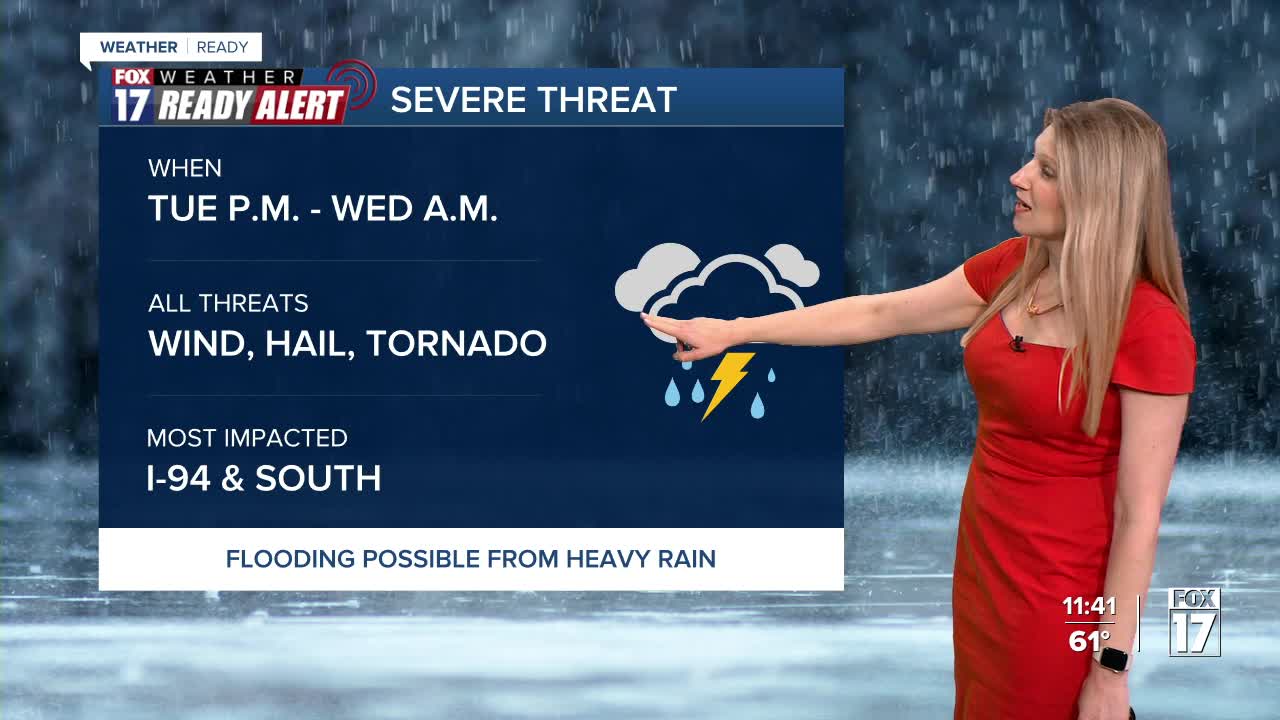


The forecast from FOX 17 Weather Ready Meteorologist Kara James: West Michigan had a beautiful and record-breaking Monday, but it turns much more active Tuesday and continuing for the rest of the week. We've issued a FOX 17 WEATHER READY ALERT DAY for the possibility of strong to severe storms Tuesday night into early Wednesday morning. Hail, wind, and a few tornadoes are all possible during this time frame. During the day Tuesday, cloudy skies will be around with pockets of drizzle. A warm front will try to lift through West Michigan. Areas south of the front will be very warm but cooler north, with higher chances of storms in the warmer areas. Right now, that front looks like it will make it to the I-94 corridor with all storm hazards possible: gusty winds, hail, and a brief tornado or two. Heavy rain could also lead to street flooding. Storms and rain end Wednesday morning, and colder air drawn in Wednesday afternoon may change rain to snow. No accumulation is expected. The remainder of the week will be much colder with more seasonable temperatures for this time of year. Another system will bring some rain/snow Thursday night into Friday.
TONIGHT: Increasing clouds. Drizzle possible late. Lows in the mid 40s. Winds southeast at 5 to 10 mph.
TUESDAY: Mostly cloudy with pockets of drizzle. Thunderstorms move in during the late evening and overnight. Some storms may be strong to severe. Hail, wind, tornadoes all possible. Highs in the upper 50s to near 60. Winds east-northeast at 5 to 10 mph.
WEDNESDAY: Cloudy with rain likely, especially in the morning. Rain could mix with snow early. Highs in the mid 40s early, then falling through the day.
THURSDAY: Mostly sunny to partly cloudy and cool. Highs around 40.
FRIDAY: Rain and snow showers likely. Windy. Highs in the lower 40s.
SATURDAY: Partly sunny. Becoming mostly cloudy in the evening with the chance of rain/snow showers late. Highs around 40.
SUNDAY: Rain and snow showers likely. Highs in the lower 40s.
MONDAY: Colder. Lake effect snow showers possible. Highs in the upper 20s.
For the latest details on the weather in West Michigan, head to the FOX 17 Weather page.
Follow FOX 17: Facebook - X (formerly Twitter) - Instagram - YouTube
