
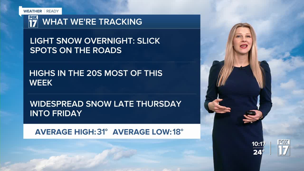


WEST MICHIGAN — From Fox 17 Weather Ready Meteorologist Kara James: Lingering areas of light snow continue on and off overnight but should not accumulate much beyond a dusting. A few slick spots on the roads are possible too, so drive carefully! This week will be less active and warmer than recent weeks, with mostly cloudy days and highs in the 20s. Morning temperatures will still be chilly, in the high single digits and low teens. But with less wind, the wind chills will not be as extreme as last week. The next impactful system at this time looks to be late Thursday into Friday, with several inches of widespread snow possible. Another Arctic blast heads to West Michigan this weekend, with single digit mornings and afternoons in the teens. In the world of weather folklore,"Punxsutawney Phil" saw his shadow and is forecasting 6-more weeks of winter.
TONIGHT: Mostly cloudy with scattered areas of flurries. Cold and quiet. Lows in the mid-teens. Winds: W 5-10 mph
TUESDAY: Mostly cloudy with scattered areas of flurries. Highs in the mid-20s. Winds: NW 5-10 mph
WEDNESDAY: Partly cloudy. Highs in the mid-20s.
THURSDAY: Mostly cloudy. Late day snow showers. Highs: mid-upper 20s.
FRIDAY: Mostly cloudy with snow showers. Highs in the low-30s.
SATURDAY: Sharply colder. Few snow showers. Highs in the upper teens.
SUNDAY: Mostly cloudy. Highs in the mid-20s.
MONDAY: Mostly cloudy. Highs around 20.
For the latest details on the weather in West Michigan, head to the FOX 17 Weather page.
Follow FOX 17: Facebook - X (formerly Twitter) - Instagram - YouTube
