
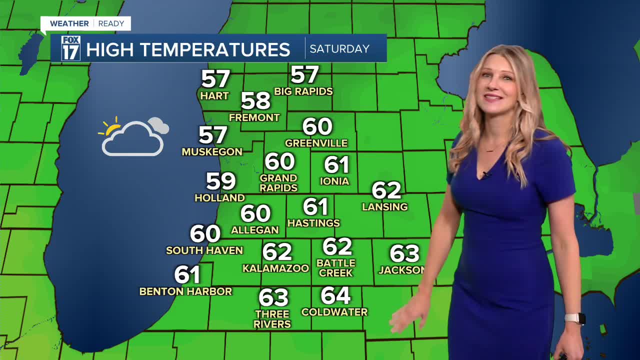


The forecast from FOX 17 Meteorologist Kara James: There are no significant systems on the immediate horizon for West Michigan! A warm front lifting through overnight keeps lows in the 40s, and highs briefly touch 60 Saturday ahead of a cold front. It will be breezy with wind switching to the northwest in the afternoon behind the front, with gusts up to 25 mph. One or two very light showers will be possible but most stay dry. Behind the front is much colder air, bringing 40s for highs once again and a strong wind Sunday. Temperatures hover in the 40s with mainly quiet conditions for most of the week. The next system that could bring meaningful rain arrives next Thursday into Friday. Stay tuned to FOX 17 for your latest forecast.

TONIGHT: Increasing clouds but not as cold. Lows in the mid-40s. Winds: South 5 - 10 mph.
SATURDAY: Mostly cloudy and breezy. Few isolated showers. Highs in the upper 50s.
SUNDAY: Mostly sunny, breezy and colder. Highs in the upper 40s.
MONDAY: Partly cloudy and cool with highs in the low 40s.
TUESDAY: Mostly cloudy and cool. Highs in the mid 40s.
WEDNESDAY: Mostly cloudy with highs in the mid to upper 40s.
THURSDAY: Mostly cloudy with highs in the mid 40s. Chance of rain in the evening and overnight.
FRIDAY: Mostly cloudy with showers likely. Highs in the mid 50s.
For the latest details on the weather in West Michigan, head to the FOX 17 Weather page.
Follow FOX 17: Facebook - X (formerly Twitter) - Instagram - YouTube
