
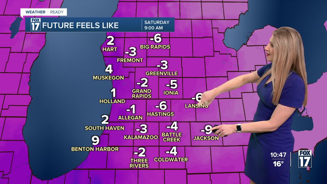


WEST MICHIGAN — From Fox 17 Weather Ready Meteorologist Kara James: Temperatures fall quickly this evening as frigid Arctic air surges in from the north. Single digit temperatures with sub-zero wind chills happen by 7 p.m. and continue to drop overnight. Wind chills will be as low as -10 early Saturday morning, with lows Saturday morning from 3 to 8. The high will help keep sunshine around during the afternoon, but temperatures only reach the upper teens to around 20. A quick system late Saturday into early Sunday morning will drop around half an inch to an inch of snow, but impacts should be minimal. Sunday will be chilly, in the 20s, but warmer than Saturday. Warmer weather returns next week with a mainly quiet pattern, but we will have to watch for occasional rounds of light snow or wintry mix.
TONIGHT: Clearing and very cold. Lows 0 to 6. Wind Chills: -5 to -10. Winds: NNW 10 - 15 mph.
SATURDAY: Very cold. Partly cloudy, isolated lake effect snow showers. Highs in the upper teens to lower 20s. Wind chills: 5-10.
SUNDAY: Mostly cloudy with morning snow showers. Highs in the mid-20s.
MONDAY: Mostly cloudy. Not as cold. Highs in the low-30s.
TUESDAY: Considerable cloudiness. Highs in the upper 30s.
WEDNESDAY: Mostly cloudy. Highs in the low 30s.
THURSDAY: Mostly cloudy. Highs in the low 30s.
Friday: Partly cloudy. Highs in the low 30s.
For the latest details on the weather in West Michigan, head to the FOX 17 Weather page.
Follow FOX 17: Facebook - X (formerly Twitter) - Instagram - YouTube
