
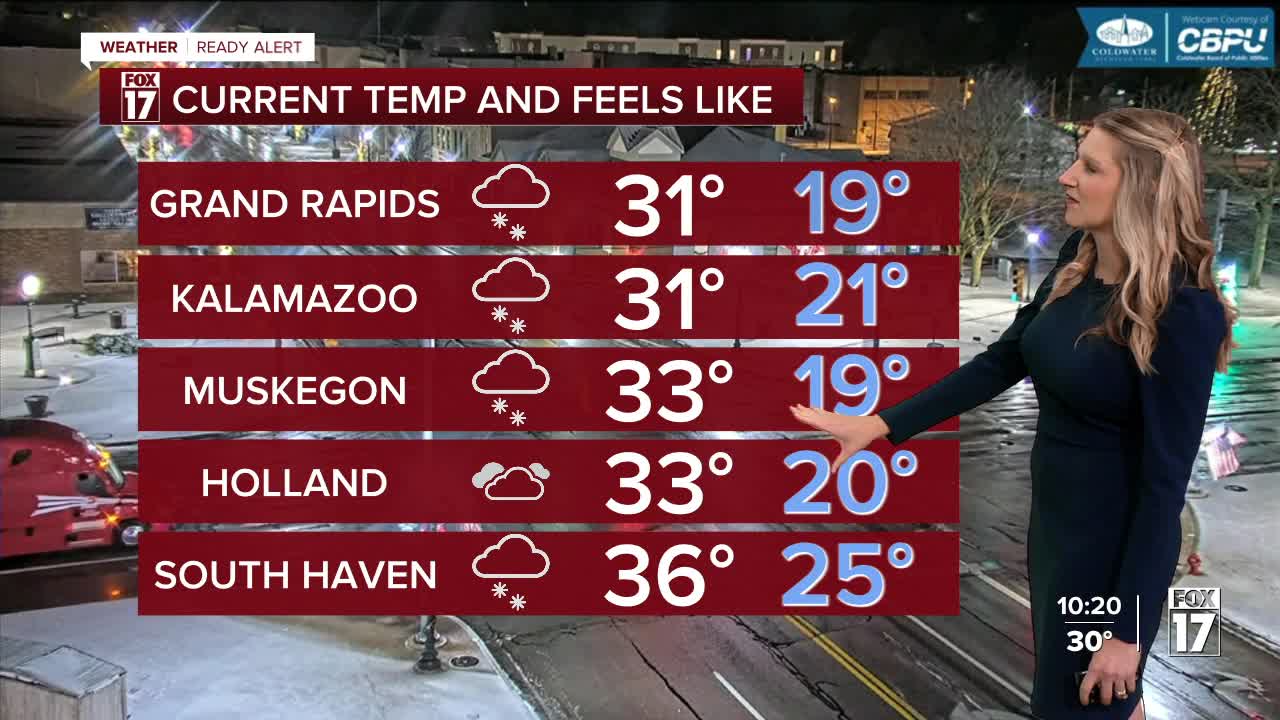


The forecast from FOX 17 Meteorologist Kara James: Winter is here! Snow will continue falling and accumulating tonight, as winds gust as high as 40-50 mph. WINTER ALERTS and WIND ALERTS continue through Thanksgiving Day for widespread snow and gusty winds, leading to blowing snow, low visibility and possible power outages. Expect poor travel conditions through at least midday Thursday, with some spots continuing to see heavy lake effect snow on Thanksgiving Day. Totals through Friday morning look to be between 4" and 8" with some significantly higher totals possible in pockets north of I-96 and around the I-94 corridor. With strong winds, low visibility and wind chills in the teens, this will be a true taste of Winter weather. There is also yet another system looking to bring another 3-6" of widespread snow to the region this weekend, continuing our travel woes. Looking ahead into the first week of December; the "colder than average" pattern shift continues. Stay tuned to the FOX 17 Weather Ready Team for your latest forecast.

TONIGHT: Temps falling into the upper 20s with lake effect snow and gusty winds. Low visibility at times. West/northwest at 10 to 20 mph, gusts 45 to 55 mph possible.
THANKSGIVING: Much colder with scattered snow showers, especially near the lakeshore. Highs in the low to mid 30s. Breezy west wind.
FRIDAY: Cold with scattered lake effect snow showers. Highs in the low to mid 30s.
SATURDAY: Remaining cold with snow showers building in the afternoon. Highs in the low 30s
SUNDAY: Snow showers, heavy at times. Highs in the mid-30s.
MONDAY: Chance lake effect snow showers. Highs in the upper 20s.
TUESDAY: Cloudy and cold. Highs in the mid 20s.
WEDNESDAY: Chance snow showers. Highs in the low 30s.
For the latest details on the weather in West Michigan, head to the FOX 17 Weather page.
Follow FOX 17: Facebook - X (formerly Twitter) - Instagram - YouTube
