
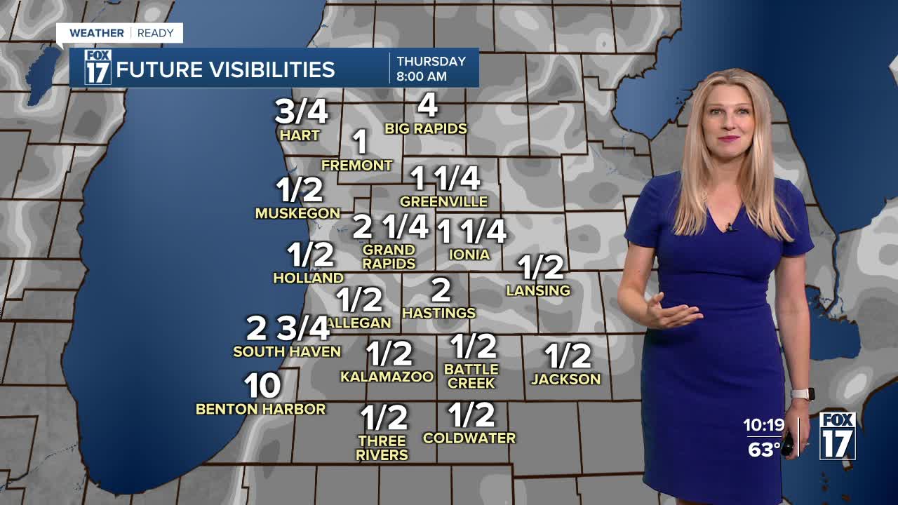


The forecast from FOX 17 Weather Ready Meteorologist Kara James: While most spots will be dry through the overnight hours, a few showers are possible as a big upper low looms overhead. Some have now seen over 3 inches of rain since Saturday night, a great boost from our worst drought conditions in 13 years! Patchy dense fog is likely to develop again tonight/early Thursday morning. Drive carefully, as visibility can change quickly over short distances! The upper low responsible for the cloudy, cooler and showery weather moves away after tomorrow. A few more showers are possible again tomorrow, but most of the rain activity will be towards Detroit. As West Michigan dries out starting Friday, temperatures will remain on the warmer side compared to average into early next week, with middle to upper 70s forecast. Make sure to stay with the FOX 17 Weather Ready Team for your latest forecast updates.

TONIGHT: Muggy and mild with a few isolated showers possible. Lows in the upper 50s. Winds: North 5 mph
THURSDAY: Partly cloudy with highs in the low 70s. Slight chance of a shower.
FRIDAY: Mostly sunny with highs in the mid 70s.
SATURDAY: Partly cloudy. Highs in the mid to upper 70s.
SUNDAY: Partly cloudy. Highs in the upper 70s.
MONDAY: Mostly sunny and Pleasant. Highs around 80.
TUESDAY: Mostly sunny and warm. Highs in the upper 70s.
WEDNESDAY: Partly cloudy. Highs in the low to mid 70s.
For the latest details on the weather in West Michigan, head to the FOX 17 Weather page.
Follow FOX 17: Facebook - X (formerly Twitter) - Instagram - YouTube
