
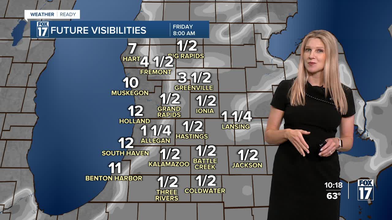


WEST MICHIGAN — The forecast from FOX 17 Weather Ready Meteorologist Kara James: It will be partly cloudy and slightly cooler overnight, with a few patches of fog forming after midnight. A big pattern shift arrives tomorrow: a large high pressure nudging in from the Plains will bring dry, sunny and very warm weather to West Michigan for the next week to 10 days. The first weekend of Fall will feature more of a "late Summer" air mass, and there is potential for some highs in the 80s Saturday through Tuesday. Average highs this time of year are in the upper 60s to low 70s, so this is very warm compared to where we should be. Mid-week next week temperatures could cool down a few degrees, but are likely to remain above average through the first week of October. The dry weather is nice for outdoor activities, but will worsen drought conditions. Make sure to stay with the FOX 17 Weather Ready Team for your latest forecast updates.
TONIGHT: Patchy fog possible. Partly cloudy, lows in the low-mid 50s Winds: NW 5-10 mph
FRIDAY: Mostly sunny with highs in the mid 70s. Winds: SW 5-10 mph
SATURDAY: Mostly Sunny. Highs in the mid to upper 70s.
SUNDAY: Mostly Sunny. Highs in the upper 70s to near 80.
MONDAY: Mostly sunny and Pleasant. Highs around 80.
TUESDAY: Mostly sunny and warm. Highs in the upper 70s.
WEDNESDAY: Partly cloudy. Highs in the low to mid 70s.
THURSDAY: Partly Cloudy. Highs around 70.
For the latest details on the weather in West Michigan, head to the FOX 17 Weather page.
Follow FOX 17: Facebook - X (formerly Twitter) - Instagram - YouTube
