


WEST MICHIGAN — From Fox 17 Weather Ready Meteorologist Kara James: Any lingering lake effect snow will wind down after midnight, but another inch of snow is possible before it all ends. Limited travel impacts are expected, but watch for slick spots on the roads tonight and early tomorrow morning. It will be cold overnight with lows in the teens. Friday will be a mostly cloudy and cold day, but we should get a few peeks of sunshine in the afternoon! Arctic air lingers through the weekend, with highs staying in the low to mid 20s. While it won't be quite as windy as previous days, wind chills will be running around 10 degrees colder. There are no significant systems looming on the horizon, but a moderating trend is in sight for next week. Another quick system overnight Sunday into Monday morning brings 1-2" of snow, and then the warm up back to the 30s begins!
TONIGHT: Snow gradually ends after midnight. Totals: 1-2". Lows in the upper teens. West wind 5 to 10 mph.
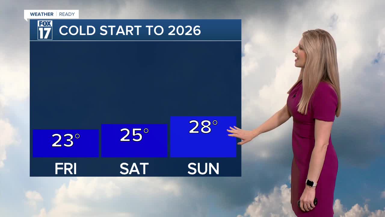
FRIDAY: Mostly cloudy early, with sunshine in the afternoon. Remaining cold. Highs in the low 20s.
SATURDAY: Mostly cloudy. Highs in the mid-upper 20s.
SUNDAY: Mostly cloudy. Highs in the upper 20s.
MONDAY: Mostly cloudy with morning snow showers. Not as cold. Highs in the mid 30s.
TUESDAY: Mostly cloudy with chance afternoon rain showers or wintry mix. Highs in the mid 30s.
WEDNESDAY: Mostly cloudy. Highs in the mid-upper 30s.
THURSDAY: Cloudy with chance evening/overnight rain showers. Highs in the upper 30s.
For the latest details on the weather in West Michigan, head to the FOX 17 Weather page.
Follow FOX 17: Facebook - X (formerly Twitter) - Instagram - YouTube
