


WEST MICHIGAN — From Fox 17 Weather Ready Meteorologist Kara James: After some partial sunshine helped take the chill out of this afternoon's highs in the low 30s, we have one more very cold night tonight before a longer lived warm up moves in to West Michigan. Lows will fall to around 12 overnight with light wind and little cloud cover. Nearby high pressure will contribute to more sunshine and highs in the upper 30s and low 40s through the weekend. Even warmer air arrives early next week, with mid to upper 40s likely Monday through Wednesday, while continuing to stay mainly dry. The next system to impact West Michigan will be mid to late week next week. Wednesday looks to be all rain, but colder air wrapping in on Thursday and Friday could lead to a wintry mix or snow. The track of the low will determine the type of precipitation, which will get ironed out as we get closer to next week.
TONIGHT: Partly cloudy. Cold. Lows around 12. Light wind.
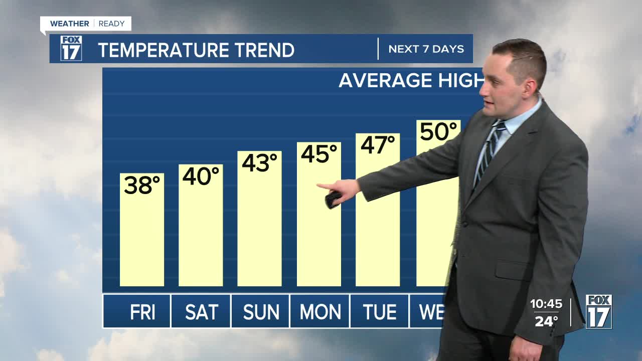
FRIDAY: Partly cloudy and warmer. Highs in the upper 30s. Wind: SW 5 to 15 mph.
SATURDAY: Mostly sunny. Highs around 40.
SUNDAY: Mostly sunny. Highs in the low 40s.
MONDAY: Variably cloudy. Highs in the mid-40s.
TUESDAY: Partly cloudy with highs in the mid-40s.
WEDNESDAY: Chance showers. Highs in the mid-upper 40s.
THURSDAY: Chance rain/snow mix. Highs in the upper 30s.
For the latest details on the weather in West Michigan, head to the FOX 17 Weather page.
Follow FOX 17: Facebook - X (formerly Twitter) - Instagram - YouTube
