


The forecast from FOX 17 Weather Ready Meteorologist Kara James: A FOX 17 WEATHER READY ALERT continues with more rain, wind, and cool air from the cut off low over northern Michigan. Lake effect and lake enhanced rain showers won't end until early Friday. The coldest air of the season remains until then, only reaching the upper 40s to near 50 along with a stiff 15 to 20 mph breeze. Feels like temperatures Thursday and Friday will be in the low/mid 40s. A strong high pressure system moves in for the weekend, keeping us clear and pleasant. Our first freeze is possible Saturday morning. Cover the plants or bring them indoors! Stay with the FOX 17 Weather Ready Team for your latest forecast updates.
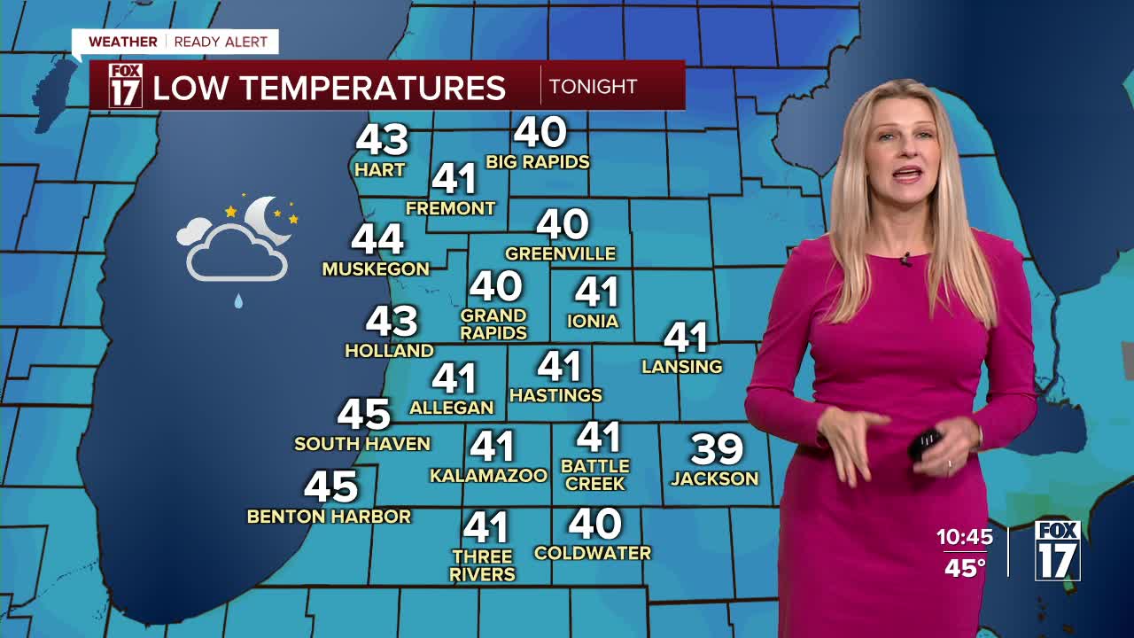
TONIGHT: Cloudy with on and off rain showers. Lows around 40, feels like temperatures in the mid-30s. Winds west-northwest at 10 to 15 mph.
THURSDAY: Mostly cloudy, breezy, blustery, and cold with showers likely. Highs in the upper 40s to near 50. Winds west-northwest at 10 to 15 mph.
FRIDAY: Partly cloudy to partly sunny. Highs in the lower 50s.
SATURDAY: Mostly sunny. Highs in the mid 50s.
SUNDAY: Mostly sunny to partly cloudy. Highs in the upper 50s.
MONDAY: Mostly sunny to partly cloudy. Highs around 60.
TUESDAY: Mostly sunny and breezy with isolated showers possible. Highs in the mid 50s.
WEDNESDAY: Mostly cloudy with scattered showers. Highs in the low 50s.
For the latest details on the weather in West Michigan, head to the FOX 17 Weather page.
Follow FOX 17: Facebook - X (formerly Twitter) - Instagram - YouTube
