


The forecast from FOX 17 Meteorologist Kara James: There is another opportunity tonight to view the Northern Lights! If you get a picture, send us your photos! It will be mostly clear and chilly tonight, with lows in the mid 30s. Meanwhile, there will be no more significant snow in the next week as a big warm up sets in. Highs continue to rise into the 50s with lots of sunshine through the end of the work week. A strong west/northwest wind will mix the atmosphere and accelerate snowmelt for lake shore communities, too. Highs will peak near 60 Saturday afternoon before evening rain chances and a cold front drops in, bringing 40s for highs once again and a strong wind Sunday. Stay tuned to FOX 17 for your latest forecast.
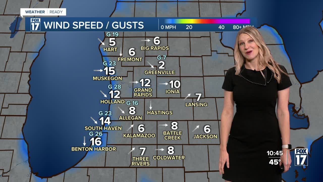
TONIGHT: Clearing skies as temperatures fall to the lower 30s. Watch for the northern lights! Winds west/northwest at 5 to 15 mph.
THURSDAY: Mostly sunny and pleasant Highs around 50.
FRIDAY: Mostly sunny, pleasant, and warmer. Highs in the mid 50s.
SATURDAY: Mostly cloudy and mild. Chance of P.M./night rain showers. Highs in the upper 50s.
SUNDAY: Mostly sunny, breezy and colder. Highs in the upper 40s.
MONDAY: Partly cloudy and cool with highs in the low 40s.
TUESDAY: Mostly cloudy with rain / snow showers possible. Highs in the mid 40s.
WEDNESDAY: Mostly cloudy with highs in the mid to upper 40s.
For the latest details on the weather in West Michigan, head to the FOX 17 Weather page.
Follow FOX 17: Facebook - X (formerly Twitter) - Instagram - YouTube
