
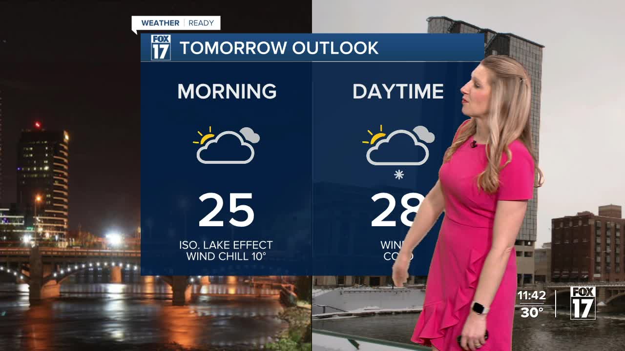


The forecast from FOX 17 Meteorologist Kara James: A clipper system tracking through the Great Lakes brought a quick half inch to an inch for most spots in West Michigan, with mainly grassy and elevated areas with the higher accumulations. Other than a few stray flurries and light snow showers overnight, many stay dry but cold with lows in the mid 20s and wind chills in the teens. It will continue to be cold and gusty with highs Wednesday in the 20s and wind chills in the single digits for most of the day. A few lake effect snow showers are possible during the day but will not cause any impacts. The remainder of the work week looks mainly dry, with the warmest day Friday in the mid/upper 40s. Saturday night into Sunday the next system arrives, with the chance for snow showers and continued colder air. Longer range temperature outlooks still keep Michigan in at/above normal readings into the first full week of March. Normal highs are in the mid 30s, so no Arctic air is on the horizon.
TONIGHT: Cloudy with wind chills around 10 to 15. Lows in the low 20s. Winds: SW/W 10 to 15 mph.
WEDNESDAY: Morning clouds/flurries, otherwise mostly cloudy and breezy. Highs in the upper 20s, wind chills in the teens. Winds: NW 10 to 20 mph.
THURSDAY: Partly cloudy to partly sunny. Highs in the lower 30s.
FRIDAY: Mostly sunny to partly cloudy and mild. Highs in the mid/upper40s.
SATURDAY: Mostly cloudy with a slight chance of late day snow showers. Highs around 40.
SUNDAY: Mostly cloudy. Highs in the upper 20s.
MONDAY: Mostly cloudy. Highs around 30.
TUESDAY: Cloudy sky. Highs in the upper 30s.
For the latest details on the weather in West Michigan, head to the FOX 17 Weather page.
Follow FOX 17: Facebook - X (formerly Twitter) - Instagram - YouTube
