
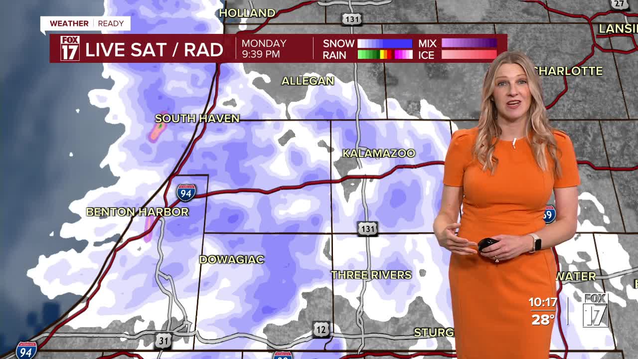


The forecast from FOX 17 Meteorologist Kara James: The FOX 17 WEATHER READY ALERT continues overnight. Lake effect snow showers will produce locally heavy accumulations in our lakeshore counties into early Tuesday morning. Reports have already come in at over 10" in Berrien County! Another 1-3" along the lakeshore is possible, with locally higher totals in Van Buren, Berrien and Cass counties. Much lighter amounts are expected inland, a dusting to maybe half an inch at best. Be careful driving Tuesday morning as roads will be slick in spots. Tuesday will be a cold, breezy day but mainly dry. Temperatures will start to warm up Thursday into the weekend, with middle to upper 50s expected and some sunshine. A system this weekend brings rain and breezy winds, and a return to cooler temperatures.

TONIGHT: WINTER STORM WARNING Oceana County and WINTER WEATHER ADVISORY Muskegon, Ottawa, Allegan, Van Buren, Berrien, and Cass County until 4am. The heaviest will be west of U.S. 131. Mostly cloudy otherwise. Winds northwest/west at 5 to 15 mph.
TUESDAY: Mostly cloudy and breezy with a chance of light/rain snow showers. Highs in the upper 30s. Winds southwest at 10 to 20 mph.
WEDNESDAY: Partly sunny to mostly cloudy. Breezy and not as cold. Highs: mid 40s.
THURSDAY: Mostly sunny. Highs: upper 40s.
FRIDAY: Mostly sunny and pleasant. Highs: mid 50s.
SATURDAY: Partly cloudy to partly sunny. Highs in the mid 50s.
SUNDAY: Mostly cloudy. Chance of showers. Highs in the mid/upper 50s.
For the latest details on the weather in West Michigan, head to the FOX 17 Weather page.
Follow FOX 17: Facebook - X (formerly Twitter) - Instagram - YouTube
