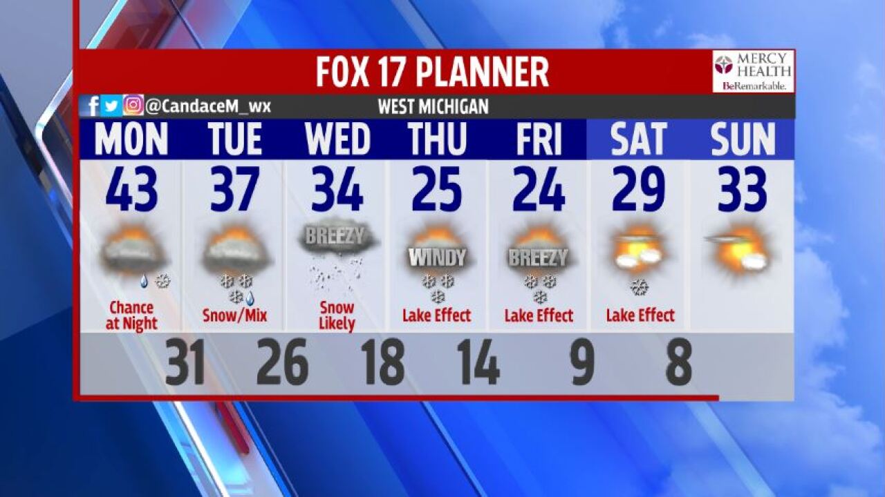
WEST MICHIGAN — After enjoying temperatures more typical of late March than late February this weekend, a slow drop in temperatures is expected this week along with the potential for significant snowfall accumulation. It looks like we'll enjoy one last mild day with highs generally in the lower to middle 40s on Monday before those readings begin to tail off.

Our attention will then turn to an area of low pressure that's developing in the west-central high Plains as of this writing.

That low over the Oklahoma panhandle will steadily move to the northeast over the next couple of days, bringing that precipitation with it. As colder air gets drawn into that system, we'll see most of the rain on the north side of that low turn to snow. However, a mix of rain and snow is possible at times... Especially as the precipitation begins late Monday night and Tuesday morning.

Some rain could continue to mix in during the day on Tuesday, especially south of I-94. This -- along with high temperatures that should still get above freezing Tuesday afternoon -- will cause the first inch or so of snow to melt as it hits the ground. So the roads should generally be in decent shape on Tuesday.

As that low moves to the east of us and it draws colder air into the region on Wednesday, the snow will begin to add up across the entire area. Some additional accumulation is also possible on Thursday and Friday as lake effect snow kicks in.

As of right now, this is how much snow the European model suggests will fall on the area between Tuesday afternoon and Thursday afternoon:

Again, these totals could be an inch or so higher than reality because of the melting that is expected to occur as the snow first begins. The exact track of the low also remains somewhat in question, and any changes could alter the above snow forecast as well.
So as always, be sure to stay tuned to FOX 17 for updates on this potential late February snow storm!


