


GRAND RAPIDS — West Michigan woke up to mostly dry conditions on Sunday with some isolated showers and storms south of I-96. An isolated shower can't be completely ruled out for the rest of the day but many of you will stay dry and partly cloudy noticing a bit more cloud cover than yesterday. Plan on seasonable temperatures with a comfortable air mass still.

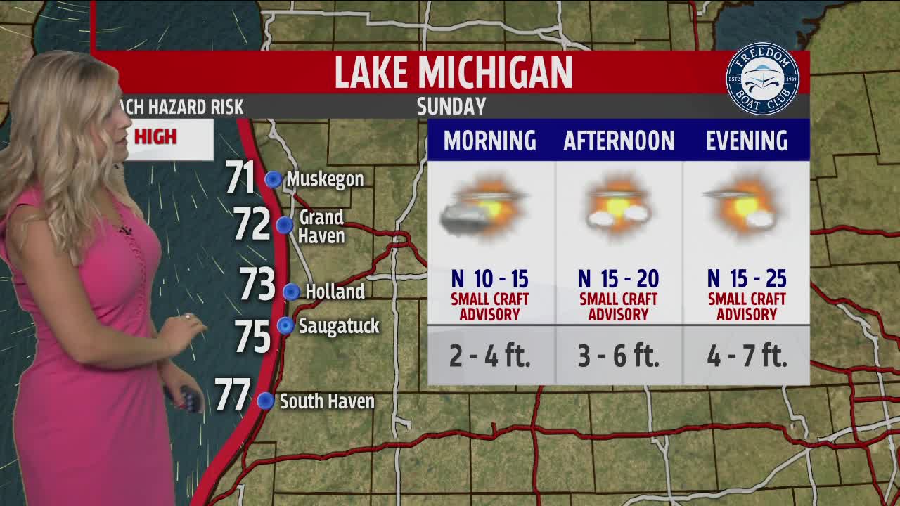
Lake Michigan will not be a safe place to be as waves build today. Winds will be mostly out of the north and pick up the waves upwards of 7 feet by this evening. Stay out of the water and off the piers as we will have dangerous swimming conditions and rip currently likely. Be safe and smart if you do happen to be along the lakeshore today.

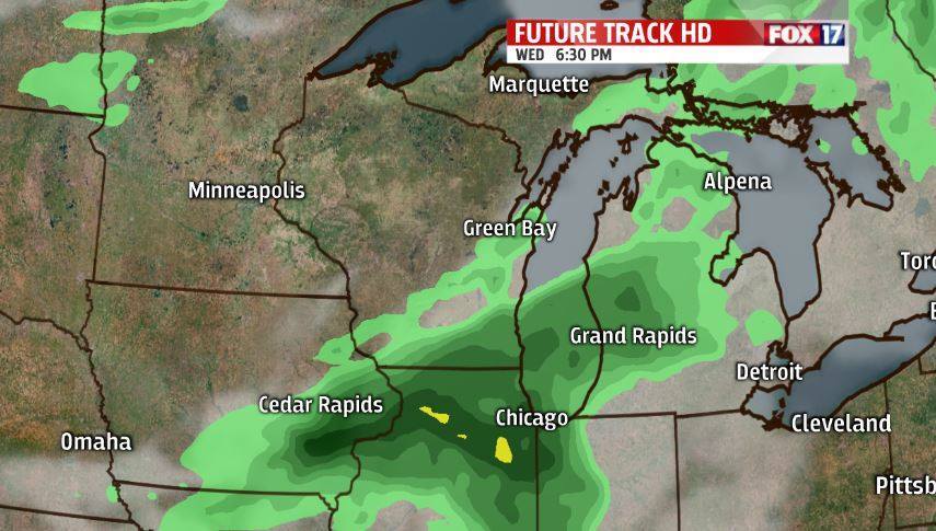
Our next best chance of rain arrives on Wednesday with widespread showers and storms possible. We could have some stronger storms that we will keep an eye on leading into the middle of this week. Make sure to download the Fox 17 mobile weather app to stay connected with us. These showers and storms can linger into the early hours of Thursday as well.
A second heatwave comes back to West Michigan by the end of next week. We will be talking 90 degrees and humidity again by Thursday. Saturday we currently expect 95 degrees with feel like or heat index numbers being at 100 degrees or better. We will have several days to stay cool and plenty hydrated once again.

