

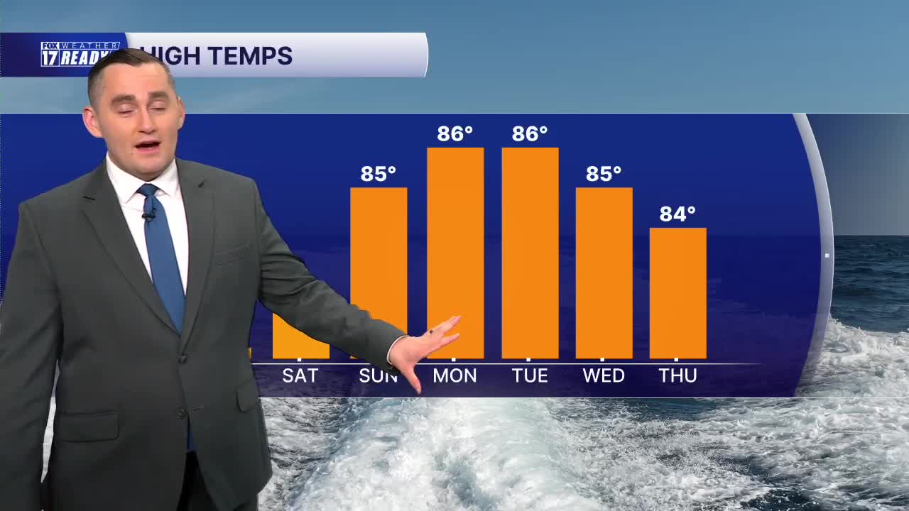


WEST MICHIGAN — The forecast from FOX 17 Weather Ready Meteorologist Colton Cichoracki: A cool and clear night is ahead for West Michigan which is good news because there is a partial lunar eclipse happening tonight. The maximum eclipse is at 12:12 a.m., and mostly clear skies will create perfect viewing conditions! Temperatures will be in the lower 60s around midnight so it will feel nice out. You will definitely need a jacket though for early Friday morning as temperatures bottom out in the low to middle 50s. Friday will be a nice day with a mix of sun and clouds, low humidity, and highs near 80. Temperatures will warm up this weekend along with an increase in humidity as a heat dome builds to our south. We will be in the lower 80s on Saturday and middle 80s on Sunday. We will stay dry through much of the weekend, but more unsettled weather returns heading into next week with rain and storm chances Monday, Tuesday, Wednesday, and potentially even Thursday. Summer-like temperatures will continue as well, staying in the middle 80s.
TONIGHT: Mostly clear and cool. Lows in the low/mid 50s. Wind NE at 5-10 mph. Great for viewing the eclipse!
FRIDAY: Mostly sunny with highs in the upper 70s/around 80 with low humidity. Wind becoming W at 5-10 mph.
SATURDAY: Partly cloudy turning mostly cloudy with highs in the lower 80s.
SUNDAY: Mostly cloudy with highs in the mid 80s and humid. Chance showers/storms late.
MONDAY: Mostly cloudy with chance showers/storms. Highs in the mid 80s and humid.
TUESDAY: Mostly cloudy with chance showers/storms. Highs in the mid 80s.
WEDNESDAY: Chance showers early, then partly cloudy with highs in the mid 80s.
THURSDAY: Chance showers/storms early, then partly cloudy with highs in the mid 80s.
Want alerts when inconvenient or severe weather is headed your way? Download the FOX 17 Weather app and set up notifications for where you live.
For the latest details on the weather in West Michigan, head to the FOX 17 Weather page.
Follow FOX 17: Facebook - X (formerly Twitter) - Instagram - YouTube
